Search Results
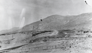
Placer miners using hydraulic methods: photographic print
Date
Archival Collection
Description
From the Nye County, Nevada Photograph Collection (PH-00221) -- Series V. Smoky Valley, Nevada and Round Mountain, Nevada -- Subseries V.C. Lofthouse-Berg Families (Round Mountain).
Image
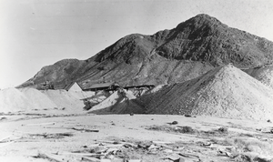
Mining operation: photographic print
Date
Archival Collection
Description
From the Nye County, Nevada Photograph Collection (PH-00221) -- Series V. Smoky Valley, Nevada and Round Mountain, Nevada -- Subseries V.C. Lofthouse-Berg Families (Round Mountain). View of a mining operation believed to be located somewhere in central Nevada, although the exact location and date are unknown. Possibly circa 1900s-1930s.
Image

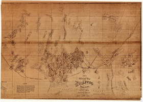
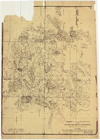
Map of the Bullfrog Mining District, Nye County (Nev.), 1905
Date
Description
Image
New official map of the Bullfrog Mining District, Nye County (Nev.), 1905
Date
Description
Image
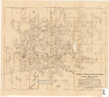
Elmer J. Chute's Map of Goldfield Mining District, Esmeralda and Nye Counties (Nev.), 1905
Date
Description
Image
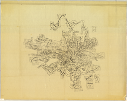
Elmer J. Chute's map of U.S. patent and location surveys in the Goldfield Mining District, Esmeralda and Nye Counties (Nev.), 1907
Date
Description
Image
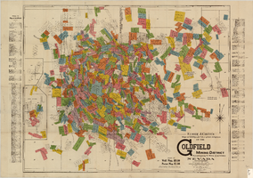
Elmer J. Chute's Diamond Map of the Goldfield Mining District, Esmeralda and Nye Counties (Nev.), 1907
Date
Description
Image
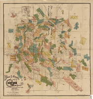
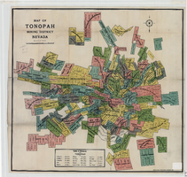
Map of the Tonopah Mining District, Nye County (Nev.), 1905
Date
Description
Image
Map of the Tonopah Mining District, Nye County (Nev.), 1905
Date
Description
Image
Map of approved mineral surveys in the Goldfield Mining District, Goldfield (Nev.), 1908
Date
Description
Image