Search Results
Mining claim: H. George and Elinor Syphyus
Date
1901-01-31
Archival Collection
Description
This folder is from "Legal Records" file of the Sadie and Hampton George Papers (MS-00434)
Text
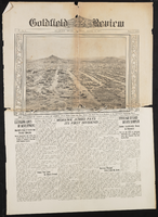
Goldfield Review: newspaper issue
Date
1907-08-17
Archival Collection
Description
From the C. A. Earle Rinker Papers (MS-00514) -- Series III: Maps, newspapers, souvenirs, and ephemera -- Newspapers from Goldfield, Nevada and various locations.
Text

Tonopah, Nevada mining map, March 1904
Date
1904-03
Description
'U.S. Geological Survey, George Otis Smith, Director.' 'R.U. Goode, Geographer in charge. Triangulation by U.S. Coast and Geodetic Survey. Topography by W.J. Peters. Surveyed in 1902-1903.' 'Edition of Mar. 1904, reprinted Apr. 1910.' Oriented with north toward the upper left. Relief shown by contours and hachures. Scale 1:12,000 (W 117°14´--W 117°12´/N 38°05´--N 38°03´)
Text
Postcard of the Harmill silver-lead mine, Montezuma (Nev.), 1929
Date
1929
Archival Collection
Description
The Harmill was being operated by Gerald B. Hartley, Sr. and was worked through the 1930s. (Gerald B. Hartley, Jr. Collection) There was an inscription on the image. "The Montezuma district was laid out after the discovery of ore in the area on May 24, 1867 by Thomas Nagle, Mat Plunkett, and a Mr. Carlyle. The district was active through the 1880s after which mining came to a standstill. Montezuma experienced a revival in the early 1900s on the heels of the Goldfield boom. Mining continued through the 1930s from operations such as the Harmill. Ore was chiefly silver accompanied by lead with some gold. Recorded production from the district was over $500,000."
Image
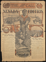
San Francisco Call - Nevada Edition: newspaper issue
Date
1905-05-23
Archival Collection
Description
From the C. A. Earle Rinker Papers (MS-00514) -- Series III: Maps, newspapers, souvenirs, and ephemera -- Newspapers from Goldfield, Nevada and various locations.
Text
Correspondence, W.H. Clarke to Levi Syphus
Date
1905-02-09
Archival Collection
Description
This folder is from the "Correspondence" file of the Sadie and Hampton George Papers (MS-00434)
Text
Authorization to sell mining interests
Date
1909-11-05
Archival Collection
Description
This folder is from "Legal Records" file of the Sadie and Hampton George Papers (MS-00434)
Text
Receipt: Sadie George
Date
1908-05-20
Archival Collection
Description
This folder is from "Financial Records" file of the Sadie and Hampton George Papers (MS-00434)
Text
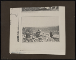
Top of the original Bullfrog Mine in Sunset Magazine: ephemera
Date
1905-08
Description
From the Nan Doughty Photograph Collection (PH-00240). Amargosa visible in the distance.
Image
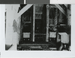
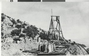
Photograph of 1200 foot level, Belmont Mine in Tonopah (Nev.), 1911
Date
1911
Archival Collection
Description
1200 ft. level, Belmont Mine, Tonopah, NV, 1911. There is an inscription on the back of the image: "The Tonopah Belmont Development Company was Tonopah's second most prosperous mining company, recording a production of $38,000,000. The Belmont mine was the company's principal working shaft and reached a depth of 1700 feet. The Belmont shaft was in use from 1909 until it was burned out by a fire of undetermined origin October 31, 1939." There is a date stamp: mid-year 1987.
Image