Search Results
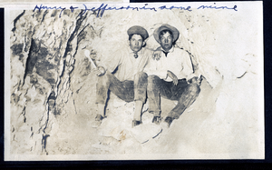
Photograph of Dalta Hurry and Raymond Jefferson in Mohawk Ledge mine, Goldfield (Nev.), early 1900s
Date
1900 to 1925
Archival Collection
Description
Caption: Hurry & Jefferson in same mine
Image
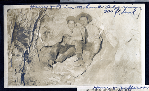
Photograph of Dalta Hurry and C. A. Earle Rinker in Mohawk Ledge mine, Goldfield (Nev.), early 1900s
Date
1900 to 1925
Archival Collection
Description
Caption: Hurry & I in Mohawk Ledge mine 300 ft level.
Image
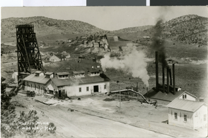
Postcard of Morris Mine, Kimberley, Nevada, circa early 1900s
Date
1900 to 1939
Archival Collection
Description
A bird's eye view of Morris Mine in Kimberley, Nevada.
Image
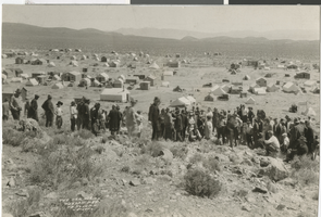
Photograph of the new strike, Weepah, Nevada, circa early 1900s
Date
1900 to 1939
Archival Collection
Description
The new strike in Weepah, Nevada. Individual Creator credit goes to N. E. Johnson Photo.
Image

Photograph of mining site, Eureka, Nevada, circa early 1900s
Date
1900 to 1910
Archival Collection
Description
Eureka, Nevada mining site.
Image
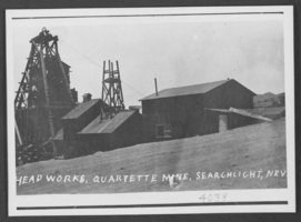
Photograph of Quartette Mine, Searchlight, Nevada, circa early 1900s
Date
1900 to 1910
Archival Collection
Description
Description provided with image: "Head works, Quartette Mine, Searchlight, Nevada."
Image
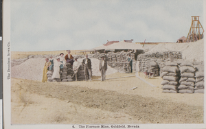
Postcard of people at the Florence Mine, Goldfield, Nevada, circa 1900s
Date
1900 to 1909
Archival Collection
Description
Color postcard of several people posing by sacks or ore outside of the Florence Mine in Goldfield, Nevada.
Image
Photograph of Lucky Strike Mine, Nevada, circa early 1900s
Date
1900 to 1939
Archival Collection
Description
A view of Lucky Strike Mine on Potosi Mountain in Nevada.
Image
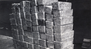
Photograph of silver bricks, Tonopah, Nevada, circa early 1900s
Date
1900 to 1939
Archival Collection
Description
Stacks of silver bricks on the depot platform in Tonopah, Nevada.
Image

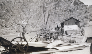
Photograph of Potosi Mine, Nevada, circa early to mid 1900s
Date
1900 to 1959
Archival Collection
Description
An exterior view of Potosi Mine in Nevada.
Image