Search the Special Collections and Archives Portal
Search Results
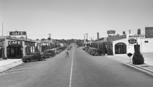
Film transparency of downtown and the Nevada Highway, Boulder City, Nevada, circa 1930-1940
Date
1930 to 1940
Archival Collection
Description
A view of downtown Boulder City and the Nevada Highway. Stores that can be seen include a cafe, a Texaco service gas station, Delmar's Drug shop, and the Reservation Grill.
Image
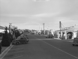
Film transparency of downtown and the Nevada Highway, Boulder City, Nevada, circa 1930-1940
Date
1930 to 1940
Archival Collection
Description
A view of downtown Boulder City and the Nevada Highway. Stores that can be seen include the Nava-Hopi Indian Store, the Green Hut Cafe, the Terminal Building, a Texaco service gas station, and Delmar's Drug.
Image
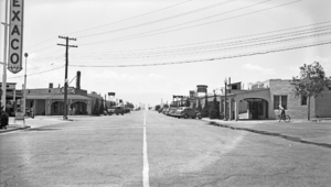
Film transparency of downtown and the Nevada Highway, Boulder City, Nevada, circa 1930-1940
Date
1930 to 1940
Archival Collection
Description
A view of downtown Boulder City and the Nevada Highway. Stores that can be seen include a Texaco service gas station, Delmar's Drug, Reservation Grill, the Nava-Hopi Indian Store, Barber Shop, and the Green Hut Cafe.
Image
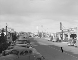
Film transparency of downtown and the Nevada Highway, Boulder City, Nevada, circa 1930-1940
Date
1930 to 1940
Archival Collection
Description
A view of downtown Boulder City and the Nevada Highway. Buildings that can be seen include the Nava-Hopi Indian Store, the Green Hut Cafe, the Bureau of Reclamation Administration building, the Terminal Building, a Texaco service gas station, and Delmar's Drug.
Image
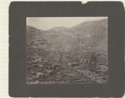
Aerial photograph of Pioche, Nevada, circa 1880s-1890s
Date
1880 to 1899
Archival Collection
Description
An aerial view of Pioche, Nevada. The Dexter Stables, Marysville Hotel, J. J. Halpin &Co. Hardware and another hardware store, furniture stores and a tobacco store are identified.
Image
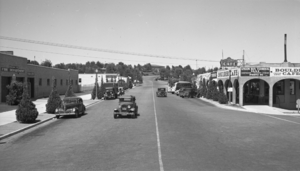
Film transparency of downtown and the Nevada Highway, Boulder City, Nevada, circa 1932-1940
Date
1932 to 1940
Archival Collection
Description
A view of downtown Boulder City and the Nevada Highway. The Boulder City Fire Department building is standing on the left side of the road, while the Terminal Building that includes the Union Bus Terminal service and Boulder Cafe is standing on the right. At the end of the street lies the Bureau of Reclamation Administration building.
Image
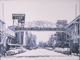
Slide of downtown Reno, Nevada, 1950s
Date
1950 to 1959
Archival Collection
Description
A black and white image of downtown Reno during the day. The illuminated neon sign bridging the two sides of the street together reads: "Reno, The Biggest Little City In The World." Pedestrians and automobiles can be seen lining the street underneath various shops and buildings such as Harold's Club, Nevada Club, Harrah's, Herz Jewelry, and the Dancing Hay Market Club.
Image
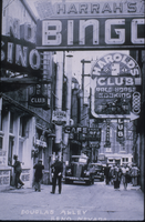
Slide of downtown Reno, Nevada, 1930s
Date
1930 to 1939
Archival Collection
Description
A black and white image of downtown Reno. People and cars are seen sharing the small space of an alleyway while neon signs hang in the air above them. Some of the signs read: "Harrah's Bingo;" "Harold's Club, Race Horse Booking;" "Redo Cafe;" and "Palace Club." Text on the bottom of the image reads: "Douglas Alley, Reno, Nevada." Site Name: Douglas Alley (Reno, Nev.)
Image

Photograph of Las Vegas, Nevada, 1905
Date
1905
Archival Collection
Description
Panoramic photograph of downtown Las Vegas Nevada, showing railroad tracks, the railyard, businesses (some in tents) and residential homes.
Image
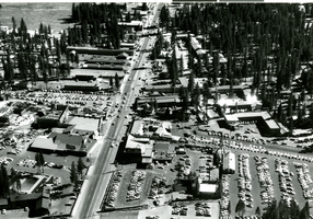
Aerial photograph of Stateline, Nevada, circa 1958
Date
1957 to 1959
Archival Collection
Description
Aerial view of Stateline, Nevada. Harrah's Tahoe is under construction on the left center of the photograph.
Address: Stateline; Douglas County; Nevada
Image
Pagination
Refine my results
Content Type
Creator or Contributor
Subject
Archival Collection
Digital Project
Resource Type
Year
Material Type
Place
Language
