Search Results
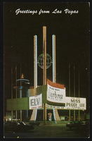
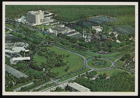
The International Hotel and Casino in Las Vegas, Nevada: postcard
Date
1940 (year approximate) to 1990 (year approximate)
Archival Collection
Description
From Harvey's Hotel and Casino Postcard Collection (PH-00367)
Image
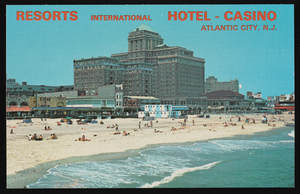
Resorts International Hotel and Casino in Atlantic City, New Jersey: postcard
Date
1940 (year approximate) to 1990 (year approximate)
Archival Collection
Description
From Harvey's Hotel and Casino Postcard Collection (PH-00367)
Image
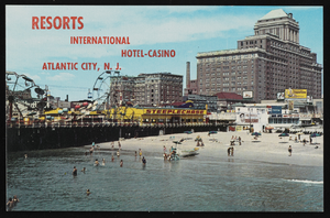
Resorts International Hotel and Casino in Atlantic City, New Jersey: postcard
Date
1940 (year approximate) to 1990 (year approximate)
Archival Collection
Description
From Harvey's Hotel and Casino Postcard Collection (PH-00367)
Image
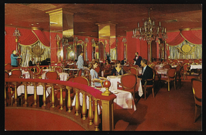
Le Palais restaurant in the Resorts International Hotel in Atlantic City, New Jersey: postcard
Date
1940 (year approximate) to 1990 (year approximate)
Archival Collection
Description
From Harvey's Hotel and Casino Postcard Collection (PH-00367). "Le Palais" is French for "The Palace"
Image
View of the International Hotel and El Casino in Freeport, Grand Bahama Island, Bahamas: postcard
Date
1940 (year approximate) to 1990 (year approximate)
Archival Collection
Description
From Harvey's Hotel and Casino Postcard Collection (PH-00367)
Image
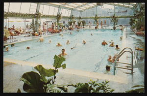
Resorts International Hotel and Casino's indoor swimming pool in Atlantic City, New Jersey: postcard
Date
1940 (year approximate) to 1990 (year approximate)
Archival Collection
Description
From Harvey's Hotel and Casino Postcard Collection (PH-00367)
Image
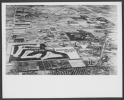
Aerial photograph of central Las Vegas, Nevada, highlighting the property planned for the International Hotel, circa 1966-1970
Date
1966 to 1970
Archival Collection
Description
Aerial photograph of central Las Vegas, with a blank property area planned for the International Hotel. The photograph, looking north to south, covers the area from Sahara Avenue south to McCarran Airport, Maryland Parkway west to the Strip. The following locations are labeled: Nevada Southern University, McCarran Airport, The Tropicana Hotel and Golf Course, the Dunes Hotel and Golf Course, the Flamingo Hotel, Caesars Palace, Castaways, the Sands Hotel, the Frontier Hotel, the Silver Slipper, the Stardust, the Hotel and Golf Course, the Landmark Tower Plaza, the Riviera,the Thunderbird, the Sahara Hotel, El Rancho Las Vegas, the Las Vegas Convention Center, International Golf Course and Hotel property, The Broadway and J.C. Penney's department stores (on the left) and Von Tobels Lumber.
Image
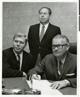
Photograph of Stuart Mason, Morry Mason, and Fred Bennioger meeting to sign a contract for the International Hotel, location unknown, circa 1969
Date
1967 to 1971
Archival Collection
Description
Pictured from left to right: Stuart Mason, Morry Mason, and Fred Bennioger meeting to sign a contract for the International Hotel, location unknown.
Image
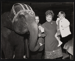
Judy Bayley and granddaughter Laura-Lisa next to Tanya, the elephant during the Cancer Crusade event at the International Hotel: photographic print
Date
1970 (year approximate)
Archival Collection
Description
From the Ann Valder Photograph Collection on Judy Bayley (PH-00324).
Image
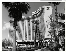
Photograph of the taxi line at the Las Vegas Hilton, circa 1979
Date
1978 to 1980
Archival Collection
Description
Taxi line in front of the Las Vegas Hilton. The International Hotel was sold in 1970 and renamed the Las Vegas Hilton in 1971.
Site Name: International Hotel
Address: 3000 Paradise Road
Image