Search the Special Collections and Archives Portal
Search Results
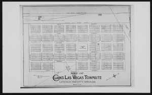
Clark's Las Vegas Townsite, Lincoln County, Nevada: map
Date
Archival Collection
Description
Image
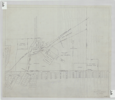
Elks Helldorado Grounds, Las Vegas, Nevada: map
Date
Description
Map of Elks Helldorado Grounds in Las Vegas, Nevada. Map is from the Library's Union Pacific Collection, maps/drawings, Las Vegas Ranch folder 5A, drawing no. F-403. Scale approximately 1:2,400.
Image

Map showing contemplated improvements to develop the Las Vegas Ranch at Las Vegas, Nevada
Date
Description
Shows springs, Clark's Las Vegas Townsite, Buck's Addition, cemetery, and State Experimental Farm. Shows township and range lines. From the Union Pacific Collection. Written on the map: "Union Pacific System, Los Angeles & Salt Lake Railroad Co., Map showing contemplated improvements to develop the Las Vegas Ranch at Las Vegas, Nev. Scale 1" - 800" Dwg. No. 31171. Office of Asst. Chief Engr., L.A.&S.L.R.R. Los Angeles, Calif., March 9, 1926. Approved: "
Image
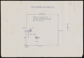
Stewart family burial site and legal records
Date
Archival Collection
Description
Stewart family burial site and legal records
Mixed Content
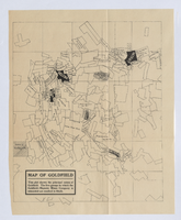
Photograph of plat map of principal Goldfield mines, Goldfield (Nev.), late 1800s
Date
Description
Caption: This plat shows the principal mines of Goldfield. The five groups in which the Goldfield-Majestic Mines Company is interested are marked in black.
Image
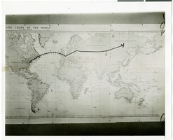
Photograph of a flight path map, July 1938
Date
Archival Collection
Description
Description printed on back of photograph: "Close up of map and miniature plane attached showing Hughes' flight to date. 7/38"
Image
