Search Results
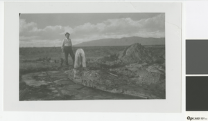
Photograph of a man standing next to an artesian well, circa early 1900's
Date
Archival Collection
Description
Man standing next to an artesian well with the Sheep Mountains in the background. Top right corner of photo had been torn off; photo restored by Annie Sattler.
Image
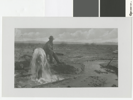
Photograph of a man sitting near an artesian well, circa early 1900's
Date
Archival Collection
Description
Man sitting next to an artesian well
Transcribed Notes: Transcribed from photo sleeve: "Man sitting near artesian well, probably Old Ranch"
Image

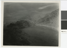
Aerial photograph of the Colorado River, Hemenway Wash, and the site of Boulder City, before 1930
Date
Archival Collection
Description
Aerial view of the Colorado River, Hemenway Wash, and the site of Boulder City
Image
Aerial photograph of Railroad Pass, Nevada, before 1930
Date
Archival Collection
Description
Aerial view of Railroad Pass looking south, U.S 93 and U.S. 95 can be seen as dirt roads.
Transcribed Notes: Stamped on back of photo: Glenn A. Davis Photographer
Image

Aerial photograph of Las Vegas and surrounding valley, circa 1920
Date
Archival Collection
Description
Aerial view of Las Vegas looking west.
Transcribed Notes: Stamped on back of photo: Glenn A. Davis Photographer
Image
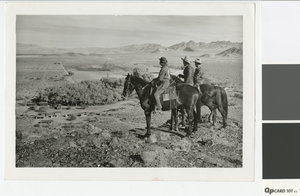
Photograph of Indian Springs from the hill behind it
Date
Archival Collection
Description
Three men on horses looking over Indian Springs
Image
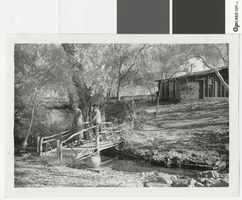
Photograph of two unidentified women on the bridge at Indian Springs, Nevada, circa 1930.
Date
Archival Collection
Description
Two women standing on the bridge that spans over the creek at Indian Springs, Nevada.
Image
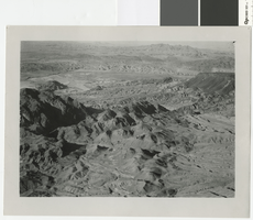
Aerial photograph of the Colorado River between Fortification Hill and Hemenway Wash, before 1930
Date
Archival Collection
Description
Aerial view of the Colorado River looking north between Fortification Hill and Hemenway Wash.
Image
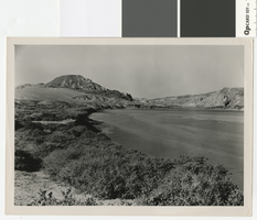
Photograph of the Colorado River above Black Canyon, before 1930
Date
Archival Collection
Description
Looking north up the Colorado River from Hemenway Wash.
Transcribed Notes: Typed inscription on back: "Nevada. Boulder Dam. The Colorado River above Black Canyon before construction of the dam."
Image

Photograph of Frenchman Mountain, Nevada, circa 1930's
Date
Archival Collection
Description
View of Frenchman Mountain from the southwest.
Transcribed Notes: Typed inscription on back: Dasjuoka Mountain
Image