Search Results
Las Vegas, Nevada LGBTQ Collection
Identifier
Abstract
The Las Vegas, Nevada Gay, Lesbian, Bisexual, Transgender, and Queer/Questioning (LGBTQ) Collection documents the social and political activities of Las Vegas, Nevada's LGBTQ community from 1955 to 2020. The collection includes hundreds of newspaper articles about LGBTQ issues, ranging from AIDS to Nevada legislation. The collection also documents the presence of the LGBTQ community in Las Vegas, including material from gay bars, nightclubs, social clubs, advocacy and political organizations, entertainers, and student groups. Previously known as the Las Vegas Gay, Lesbian, Bisexual, and Transgender Collection.
Archival Collection
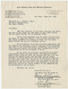
Letter from Walter R. Bracken and Al M. Folger (Las Vegas) to Mayor J. L. Russell and City Commissioners (Las Vegas), March 30, 1940
Date
Archival Collection
Description
The Las Vegas Land and Water Company informs the mayor of Las Vegas of their efforts to promote Emergency Ordinance No. 247 and of the improvements they have made to the water system to increase capacity. J. L. Russell was Mayor of Las Vegas at that time.
Text

Aerial photograph of part of the Las Vegas Valley, Las Vegas, Nevada, circa 1963
Date
Archival Collection
Description
Image
Photograph of Las Vegas Valley Water District, Las Vegas (Nev.), 1959
Date
Archival Collection
Description
Image
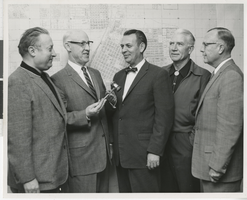
Photograph of North Las Vegas Police Department, North Las Vegas, Nevada, circa 1960s
Date
Archival Collection
Description
Image
Photograph of North Las Vegas Police Department, North Las Vegas, Nevada, circa 1960s
Date
Archival Collection
Description
Image
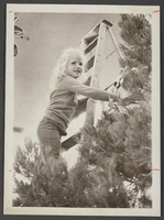
Photograph of Christmas tree at North Las Vegas Library, North Las Vegas, December 8, 1975
Date
Archival Collection
Description
Image
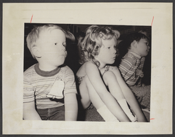
Photograph of children at North Las Vegas Library, North, Las Vegas, June 21, 1976
Date
Archival Collection
Description
Image
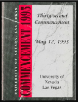
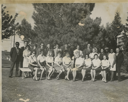
University of Nevada, Las Vegas (UNLV) 32nd commencement program
Date
Archival Collection
Description
Commencement program from University of Nevada, Las Vegas Commencement Programs and Graduation Lists (UA-00115).
Text
Las Vegas Report, Las Vegas Chamber of Commerce, 1962
Level of Description
Archival Collection
Archival Component