Search Results
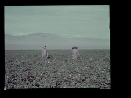
Photograph of Dorothy in cotton field, Pahrump (Nev.), circa 1951
Date
Archival Collection
Description
Image
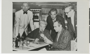
Photograph of El Rancho Vegas patrons, Las Vegas (Nev.), 1950s
Date
Archival Collection
Description
Image
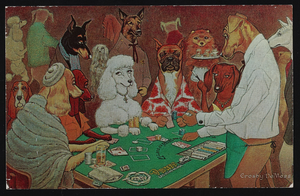
Postcard of dogs gambling at the Dunes Hotel and Casino, Las Vegas (Nev.), approximately 1900s-1980s
Date
Archival Collection
Description
Image

Transcript of interview with Rowena Gonzalez by Michael Boyd, March 1, 1977
Date
Archival Collection
Description
On March 1, 1977, Michael Boyd interviewed Rowena Gonzalez (born 1946 in Wichita Falls, Texas) about her life in Nevada. Gonzalez first talks about her family background and residential history before discussing the way of life in Texas and eventually in Las Vegas. Several topics covered in the interview include Gonzalez’s recollections of the atomic testing, the building of the Hoover Dam, and Howard Hughes. The two also discuss tourism, the properties on the Strip and in Downtown Las Vegas, and early means of transportation.
Text

Lily Teo oral history interview: transcript
Date
Archival Collection
Description
Oral history interview with Lily Teo conducted by Stefani Evans on February 7, 2022 for Reflections: The Las Vegas Asian American and Pacific Islander Oral History Project. Lily Teo discusses her upbringing in Singapore, her education, her religious beliefs, and converting from Buddhism to Catholicism. She talks about her husband, her early married years, and what life was like as a young mother of three children. Teo shares how she started a catering business to feed construction workers and was responsible for shopping for ingredients, preparing all meals and tea, and cooking the food on site in her temporary kitchen. She talks about her children, the faiths they practice and languages they speak including English, Malay, and Mandarin, and the customs and traditions they practice, such as celebrating Lunar New Year and other holidays. Lily's daughter, Stella, sits in on the interview and expands on her mother's recollections.
Text
Marie and James B. McMillan Photograph Collection
Identifier
Abstract
The Marie and James B. McMillan Photograph Collection (1900-1994) contains photographs of Marie and James B. McMillan and their families. The collection also includes photographs of their friends and professional associates, including journalist Hank Greenspun, Nevada civil rights pioneer J. David Hoggard, and entertainer Sammy Davis Jr. Marie McMillan is a former Las Vegas, Nevada flight instructor and one of the first women to work at the Nevada Test Site in Nye County, Nevada. James B. McMillan was the first African-American dentist to practice in Nevada, as well as a prominent Nevada civil rights leader.
Archival Collection

Transcript of interview of Thalia Dondero by Mary Germain, March 13, 1976
Date
Archival Collection
Description
On March 13, 1976, Mary Germain interviewed Thalia Dondero (born 1921 in Greeley, Colorado) about her life in Nevada and her experiences as the first female commissioner for the Clark County Commission. Dondero first talks about her upbringing and her eventual move to Southern Nevada. She also discusses her involvement in extracurricular activities, such as being a leader for the Girl Scouts, and how some of those experiences led her to get involved in politics. Dondero also mentions her work with National Geographic and her passion for working with oil paintings and watercolors. The final part of the interview involves some of Dondero’s accounts as a commissioner for Clark County and some of the challenges she has faced in that position.
Text

Proposal for the Xanadu Hotel and Casino (Las Vegas), October 30, 1975
Date
Description
Binder containing the proposal for the Xanadu resort, including conceptual sketches, pictures of mockups, and detailed proposal documents. Unbuilt project. Page 75 of proposal is missing. Stamped or labeled on back of photos: "Photography by Julius Shulman. P.O. Box 46206 Los Angeles, California 90046." Julius Shulman, photographer.
Image
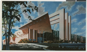
Photograph of Googie architectural design of the Sands Hotel (Las Vegas), façade, circa 1952
Date
Archival Collection
Description
Architect's proposal for the façade and porte-cochère of the Sands Hotel.
Site Name: Sands Hotel
Address: 3355 Las Vegas Boulevard South
Image
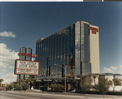
Photograph of the front exterior of the Desert Inn Hotel and Casino (Las Vegas), circa 1988
Date
Archival Collection
Description
The tower of the Desert Inn. Transcribed from photo sleeve: "Was renovated in 1978."
Site Name: Desert Inn
Address: 3045 Las Vegas Boulevard South
Image