Search Results
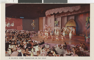
Photograph of a show, Las Vegas (Nev.), 1940s
Date
Description
Image

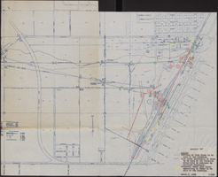
Map of Las Vegas Valley, Clark County, Nevada, October 1, 1940
Date
Archival Collection
Description
Image

Photograph of Julian Moore, Las Vegas (Nev.), 1955-1965
Date
Archival Collection
Description
Image
Musicians Wives Club of Las Vegas Roundtable interview
Identifier
Abstract
Roundtable oral history interview conducted by Lisa Gioia-Acres with some of the founding members of the Musicians Wives Club of Las Vegas on October 1, 2008 for the All That Jazz Oral History Project. Interviewees include Renee Rampton, Rosemaria Gordon, Myrna Williams, Phyllis Kluger, and Leslie Marsh. Also included are two photographs (reproductions) taken on June 4, 1964 at the installation ceremony of the first officers. Digital audio available; no transcript available; two physical photographs available.
Archival Collection

Photograph of Claudine Williams, Las Vegas, 1979
Date
Archival Collection
Description
Image
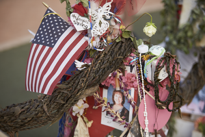
Items, including a ti leaf lei from Hawaii, left at the 1 October memorial located at the Welcome to Las Vegas sign cover a cross, looking west-northwest in Las Vegas, Nevada: digital photograph
Date
Archival Collection
Description
Following the October 1, 2017 killing of 58 people at the Route 91 Harvest Music Festival on the Las Vegas Strip, the Las Vegas community responded in a variety of ways. This series of photographs document the impromptu memorial created at the Welcome to Las Vegas sign.
Image
University of Nevada, Las Vegas Department of Allied Health Sciences Records
Identifier
Abstract
The University of Las Vegas, Nevada School of Allied Health Sciences Records (approximately 1980-1989) are primarily comprised of the rough drafts of a Radiologic Technology textbook created by the University of Nevada, Las Vegas (UNLV) School of Allied Health. The collection contains four different rough draft versions of the textbook. The collection also includes copies of self-evaluation reports, memoranda on the nursing program, and information on the health sciences disciplines at UNLV.
Archival Collection
Map of water pipelines owned by or to be sold to the Las Vegas Valley Water District, March 1, 1953
Date
Archival Collection
Description
Image
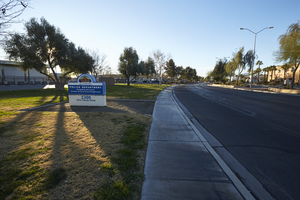
Sign for the North Las Vegas Police Department on Civic Center Drive in North Las Vegas, Nevada: digital photograph
Date
Archival Collection
Description
From the UNLV University Libraries Photographs of the Development of the Las Vegas Valley, Nevada (PH-00394). Part of the collection documents the entire 19 mile length of the north/south Eastern Avenue / Civic Center Drive alignment. This photograph was captured in the section of Civic Center Drive between Las Vegas Boulevard and Lake Mead Boulevard.
Image
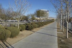
A sidewalk leads to the North Las Vegas City Hall, looking north in North Las Vegas, Nevada: digital photograph
Date
Archival Collection
Description
From the UNLV University Libraries Photographs of the Development of the Las Vegas Valley, Nevada (PH-00394). Part of the collection documents the entire 19 mile length of the north/south Eastern Avenue / Civic Center Drive alignment. This photograph was captured in the section of Civic Center Drive between Las Vegas Boulevard and Lake Mead Boulevard.
Image