Search Results
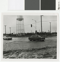
Photograph of flooding in Las Vegas, circa 1950's
Date
Archival Collection
Description
Flooding in Las Vegas at the intersection of West Charleston and Hinson Street.
Image
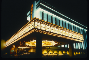
Slide of the Hacienda Hotel, Las Vegas, 1986
Date
Archival Collection
Description
Image
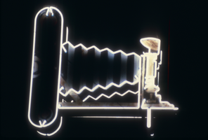
Slide of the Photo Shop, Las Vegas, 1986
Date
Archival Collection
Description
Image
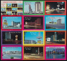
Portfolio of twelve Las Vegas Hotels: postcard
Date
Archival Collection
Description
Image
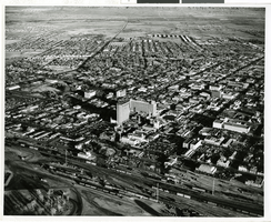
Photograph of Downtown, Las Vegas (Nev.), 1960s
Date
Archival Collection
Description
Image
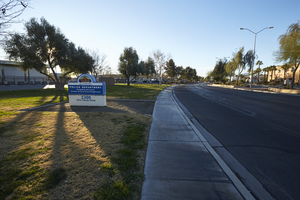
Sign for the North Las Vegas Police Department on Civic Center Drive in North Las Vegas, Nevada: digital photograph
Date
Archival Collection
Description
From the UNLV University Libraries Photographs of the Development of the Las Vegas Valley, Nevada (PH-00394). Part of the collection documents the entire 19 mile length of the north/south Eastern Avenue / Civic Center Drive alignment. This photograph was captured in the section of Civic Center Drive between Las Vegas Boulevard and Lake Mead Boulevard.
Image
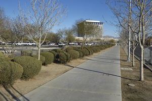
A sidewalk leads to the North Las Vegas City Hall, looking north in North Las Vegas, Nevada: digital photograph
Date
Archival Collection
Description
From the UNLV University Libraries Photographs of the Development of the Las Vegas Valley, Nevada (PH-00394). Part of the collection documents the entire 19 mile length of the north/south Eastern Avenue / Civic Center Drive alignment. This photograph was captured in the section of Civic Center Drive between Las Vegas Boulevard and Lake Mead Boulevard.
Image

Map of Las Vegas Valley, Clark County, Nevada, October 1, 1940
Date
Archival Collection
Description
Image
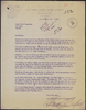
Letter from Thomas A. Campbell (Las Vegas) to Resort Hotel Committee (Las Vegas), September 21, 1953
Date
Archival Collection
Description
Campbell stating that the rumor that the water district will attempt to cap some wells in the Strip area is absolutely false. Furthermore, if the bond passes, the district plans to install a 15 inch line that would reach the Flamingo. Letter has date stamps from E.E.B. and Wm. R. and U.P. R.R. Co. L.A. Law Department. "80-11" is written in red pencil at the top and there are other pencilled notes.
Text
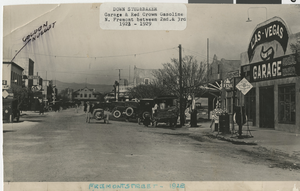
Photograph of Fremont Street, Las Vegas, 1928
Date
Archival Collection
Description
Image