Search Results
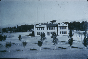
Slide of Las Vegas Grammar School, Las Vegas, 1919
Date
Archival Collection
Description
Image

The Wheel Las Vegas Rotary Club newsletter, October 7, 1976
Date
Archival Collection
Description
Text
The Wheel Las Vegas Rotary Club newsletter, 1977-1978
Date
Archival Collection
Description
Text
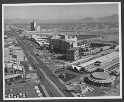
Photograph of hotels on Las Vegas Boulevard, Las Vegas, Nevada, circa 1966
Date
Archival Collection
Description
Image
The Wheel Las Vegas Rotary Club newsletter, 1960s-1970s
Date
Archival Collection
Description
Text
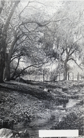
Postcard of Las Vegas Creek, Las Vegas, circa early 1900s
Date
Archival Collection
Description
Image
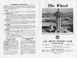
The Wheel Las Vegas Rotary Club newsletter, June 5, 1975
Date
Archival Collection
Description
Text
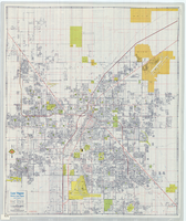
Street map of Las Vegas, North Las Vegas and vicinity, circa 1979
Date
Description
Image
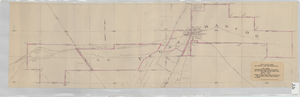
Map showing contemplated improvements to develop the Las Vegas Ranch at Las Vegas, Nevada
Date
Description
Shows springs, Clark's Las Vegas Townsite, Buck's Addition, cemetery, and State Experimental Farm. Shows township and range lines. From the Union Pacific Collection. Written on the map: "Union Pacific System, Los Angeles & Salt Lake Railroad Co., Map showing contemplated improvements to develop the Las Vegas Ranch at Las Vegas, Nev. Scale 1" - 800" Dwg. No. 31171. Office of Asst. Chief Engr., L.A.&S.L.R.R. Los Angeles, Calif., March 9, 1926. Approved: "
Image
Wynn Las Vegas Scrapbook
Identifier
Abstract
The collection consists of one scrapbook (2008) of postcards and photographs tracing the history of the Las Vegas property upon which the Wynn Las Vegas resort was built and four magazines featuring articles about Las Vegas (1940, 1947, 1955, and 1959). The scrapbook begins with several pages of historic postcards of the hotel originally built on the property, the Desert Inn, and continues with the establishment of the Wynn and the vision of its associated resort, the Encore. While the images primarily focus on the Desert Inn and the Wynn, there are also several pages of images of various other Las Vegas Strip properties accompanied by a brief timeline. The scrapbook contains approximately 76 images, dating from 1950 to 2008.
Archival Collection