Search Results
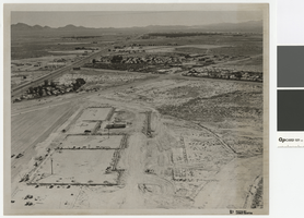
Aerial photograph of Las Vegas Blvd. and Cheyenne Ave., Las Vegas, June 5, 1973
Date
Archival Collection
Description
Aerial view of Las Vegas Blvd. and Cheyenne Avenue looking north.
Transcribed Notes: Transcribed from back of photo: "Building site of Safeway"
Image
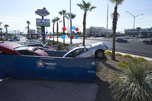
Hyundai of Las Vegas dealership on West Sahara Avenue, Las Vegas, Nevada: digital photograph
Date
Archival Collection
Description
Image
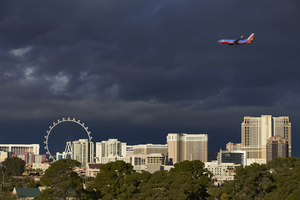
Airplane and storm clouds over Las Vegas Strip, Las Vegas, Nevada: digital photograph
Date
Archival Collection
Description
Image
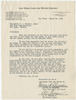
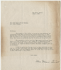
Letter from Walter R. Bracken and Al M. Folger (Las Vegas) to Mayor J. L. Russell and City Commissioners (Las Vegas), March 30, 1940
Date
Archival Collection
Description
The Las Vegas Land and Water Company informs the mayor of Las Vegas of their efforts to promote Emergency Ordinance No. 247 and of the improvements they have made to the water system to increase capacity. J. L. Russell was Mayor of Las Vegas at that time.
Text
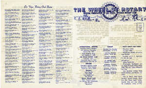
The Wheel of Rotary Las Vegas Rotary Club newsletter, September 22, 1949
Date
Archival Collection
Description
Text
Letter from Mina Stewart (Las Vegas) to Las Vegas Land and Water Company, July 2, 1936
Date
Archival Collection
Description
Mrs. Stewart reminding the Las Vegas Land and Water Co. of their responsibility to provide water for the Stewart burial plot and telling them if the company did not fix the delivery problem, legal proceedings would be initiated.
Text
Las Vegas Ranch and Las Vegas Fort photographs, approximately 1890-1940
Level of Description
Scope and Contents
The Las Vegas Ranch and Las Vegas Fort photographs depict the Las Vegas Ranch (also known as the Stewart Ranch) and the Las Vegas Fort (also known as the Old Mormon Fort) from approximately 1900 to 1940. The land around the Stewart Ranch and the Las Vegas Fort eventually became the town site for the city of Las Vegas, Nevada. The photographs include the fort, houses at the Stewart Ranch, the orchard, and Las Vegas Creek. The items described include photographic prints and negatives; items listed are photographic prints unless otherwise specified.
Archival Collection
Archival Component
Las Vegas High School Architectural Drawings
Identifier
Abstract
The Las Vegas High School architectural drawings include blueprints for various improvements, expansions, additions, and renovations performed for the Las Vegas, Nevada high school between 1929 and 1972. The architectural drawing sets include site plans, floor plans, elevations, sections, building component details, and structural drawings.
Archival Collection
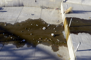
Water and trash in the Las Vegas Wash in North Las Vegas, Nevada: digital photograph
Date
Archival Collection
Description
From the UNLV University Libraries Photographs of the Development of the Las Vegas Valley, Nevada (PH-00394). Part of the collection documents the entire 19 mile length of the north/south Eastern Avenue / Civic Center Drive alignment. This photograph was captured in the section of Civic Center Drive between Alexander Road and Cheyenne Avenue.
Image
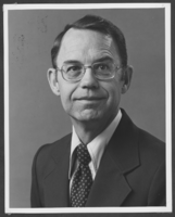
Photograph of Mayor James Seastrand, Las Vegas, 1982
Date
Archival Collection
Description
Image