Search the Special Collections and Archives Portal
Search Results
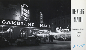
Postcard of Fremont Street, Las Vegas, circa late 1940s
Date
Archival Collection
Description
Image
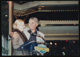
Vassili Sulich with a woman, image 012: photographic print
Date
Archival Collection
Description
Image
"Talking Stories: A Panel of the City of Las Vegas AAPI Committee" panel discussion
Identifier
Abstract
This Asian American and Pacific Islander Day panel discussion, "Talking Stories: A Panel of the City of Las Vegas AAPI Committee," features six panelists and was moderated by Allycia B. Murphy, Deputy City Attorney, Office of the City Attorney, Criminal Division. Panelists include Cynthia Leung, Chief Judge for Las Vegas Municipal Court; Jennifer Rabanes, Recreation Coordinator at Centennial Hills Active Adult Center; Patricia Cabrera, Enterprise Records Officer, City Clerk's office; Joey Boquecosa, Equipment Operator, Public Works Department; Natasha Shahani, Senior Public Information Officer; and Gai Phanalasy, Multimedia Production Specialist. The panel was held at Las Vegas City Hall on May 11, 2023, following Las Vegas Mayor Carolyn Goodman's declaration of May 11, 2023, as "Asian American and Pacific Islander Day." Anticipating the proclamation, the City's AAPI employees formed the City of Las Vegas AAPI Committee to organize the City's first AAPI Appreciation Day at City Hall. The Committee invited several local AAPI performers, organizations, and social, cultural, and advocacy groups to celebrate, honor, and recognize the City's AAPI employees across all departments.
Archival Collection
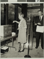
Photograph of Cornerstone ceremony, Las Vegas, 1976
Date
Archival Collection
Description
Description provided with image: "Dr. Juanita White, Cornerstone Ceremony, 1976."
Image
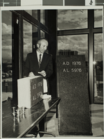
Photograph of Cornerstone ceremony, Las Vegas, 1976
Date
Archival Collection
Description
The Cornerstone Ceremony at the University of Nevada, Las Vegas.
Image
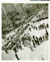
Photograph of a parade for Howard Hughes, New York City, July 15, 1938
Date
Archival Collection
Description
Image

