Search the Special Collections and Archives Portal
Search Results
LeCain, G.D.; Anna, L.O.; and Fahy, M.F. 2000. Results from Geothermal Logging. Air and Core-Water Chemistry Sampling, Air-Injection Testing and Tracer Testing in the Northern Ghost Dance Fault, Yucca Mountain, Nevada. November 1996 to August 1998. Water-Resources Investigations Report 99-4210. Denver, Colorado: U.S. Geological Survey, 2000
Level of Description
Archival Collection
Collection Name: Environmental Radiation Protection Standards for Yucca Mountain, Nevada
Box/Folder: Box 39
Archival Component
Department of Energy perspective regarding standards applicable to Yucca Mountain for the protection of the public health and safety, presented at meeting of the National Academy of Sciences committee on technical bases for Yucca Mountain standards of Office of Civilian Radioactive Waste Management (OCRWM) by Stephan J. Brocoum, Director of Analysis and verification division in the Office of Geologic Disposal of the office of Civilian Radioactive Waste Management, 1993 May 27-28
Level of Description
Archival Collection
Collection Name: Citizen Alert Records
Box/Folder: Box 05
Archival Component
Glancy, P.A. and Beck, D.A. 1998. "Modern Flooding and Runoff of the Amargosa River, Nevada-California, Emphasizing Contributions of Fortymile Wash." Quaternary Geology of the Yucca Mountain Area, Southern Nevada, Field Trip Guide, Prepared for the 1998 Annual Meeting of the Friends of the Pleistocene, Pacific Cell, October 9-11, 1998. Taylor, E. M., ed. Pages 51-62. (Boulder, Colorado: Friends of the Pleistocene), 1998
Level of Description
Archival Collection
Collection Name: Environmental Radiation Protection Standards for Yucca Mountain, Nevada
Box/Folder: Box 38
Archival Component
United States Department of the Interior Geological Survey, Federal Center, Denver, Colorado 80225, Wells and Springs in California and Nevada Within 100 Miles of the Point 37 degrees 15 minutes North, 116 degrees 25 minutes West, on the Nevada Test Site - Prepared Under Agreement No. AT(29-2)-474 for the Nevada Operations Office, U.S. Atomic Energy Commission, USGS-474-85, 1971
Level of Description
Archival Collection
Collection Name: Thomas P. O'Farrell Papers
Box/Folder: Box 13
Archival Component
David L. Weide Research Papers
Identifier
Abstract
The David L. Weide Research Papers (approximately 1954-2000) are comprised of materials that represent Weide's research on geographical issues in the western United States. Collection materials include reports, U.S. Geologic Survey maps, and field notes as well as scholarly articles published by Weide. The collection also includes Weide's notes from classes and research from when he was a graduate student at the University of California, Los Angeles.
Archival Collection

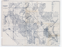
Map showing areas of bedrock and valley fill, drainage boundary, areas of artesian flow, and precipitation stations in the Las Vegas Valley area, 1946
Date
Description
Image
Chester R. Longwell Professional Papers
Identifier
Abstract
The Chester R. Longwell Professional Papers (1886-1974) document Longwell's professional career as a geologist and his pioneering field work in Clark County, Nevada. Included are Longwell's field notes; manuscripts, articles and speeches related to geology; personal and business correspondence; professional publications; subject and name files; specimen tags; photographic prints, negatives, and slides; and geological and topographical maps, primarily of Nevada, California, Arizona, and Utah.
Archival Collection

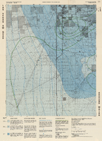
Topographic map of groundwater in the southeast quadrangle of Las Vegas, Nevada, 1980
Date
Description
Text

Newspaper clipping, Water level decline shown, Las Vegas Review-Journal, March 15, 1945
Date
Archival Collection
Description
Newspaper article summarizing a 1945 U.S. Geological Survey report of a sharp water level decline in the Las Vegas artesian basin.
Text

Topographic map of groundwater in the southwest quadrangle of Las Vegas, Nevada, 1985
Date
Description
Text
