Search Results

Plat of H.F.M & M addition to city of Las Vegas, Clark County, Nevada, comprising the west 1/2 of N.W. 1/4 Sec. 27, Twp. 20 S., R. 61 E., M.D.B & M, March 8, 1924
Date
Description
Image
T-Shirt Color: White; Front: Follow The Footsteps: The Firefighter Stephen Siller, Tunnel To Towers Run, Firefighter Running Holding American Flag; Back: Remember NYPD FDNY PAPD, Presented By Lincoln Property Company. Sponsors: TBC, Team EMG, OZ Comm., Airfield Graphics , Victory Sports, Dept. Badges For: NYPD, FDNY, PAPD, approximately 2001-2012
Level of Description
Archival Collection
Collection Name: New York-New York Hotel and Casino 9-11 Heroes Tribute Collection
Box/Folder: Box 385
Archival Component
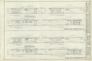
Architectural drawings of residential home in Las Vegas, Nevada, exterior elevations, 1955
Date
Archival Collection
Description
Two different sets of drawings of front, rear, left and right exterior elevations of a ranch-style residential home in the Greater Las Vegas development in Las Vegas, Nevada.
Site Name: Greater Las Vegas
Image

Blueprint map showing proposed water pipeline from Big Spring to Las Vegas, Nevada, January 24, 1911
Date
Archival Collection
Description
Image

Architectural drawing of additions and alterations to the mens' and womens' health clubs in the Sands Hotel, Las Vegas, Nevada, April 19, 1965
Date
Description
Floor plans, sections, elevations for mens' and womens' health clubs at the Sands Hotel, Las Vegas, Nevada. Includes door and finish schedules. "Sheet no. 17A. Job no. 420. Drawn by Shoji Yasuda. Job captain, Mas Tokubo. 2-26-65. Revised 4-19-65."
Site Name: Sands Hotel
Address: 3355 Las Vegas Boulevard South;
Image
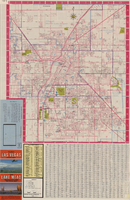
Las Vegas street map and Lake Mead Recreation Area pictorial map, 1979
Date
Description
Text
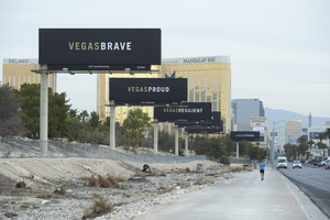
Vegas Strong billboards replaced the usual entertainment advertising along the Las Vegas Strip, looking north-northwest in Las Vegas, Nevada: digital photograph
Date
Archival Collection
Description
Following the October 1, 2017 killing of 58 people at the Route 91 Harvest Music Festival on the Las Vegas Strip, the Las Vegas community responded in a variety of ways. These photographs document a series of billboards along Las Vegas Boulevard.
Image
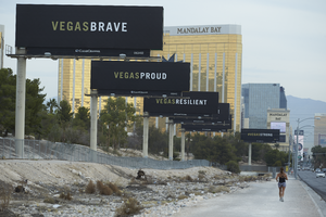

Map of Boulder Dam area and Las Vegas, Nevada, October 7, 1930
Date
Description
Text

Map showing profile of 24-inch cast iron water pipeline for Las Vegas, Nevada, May 20, 1930
Date
Archival Collection
Description
Image