Search Results
Myers, W. A., 1997, "Environmental Impact Statement (EIS) for the F-22 Follow-on Operational Testing and Evaluation and Weapons School Beddown, Nellis AFB, Nevada." memorandum with attachment to W. Dixon (Yucca Mountain Site Characterization Office, U. S. Department of Energy), received April 1997, Chief, Environmental Planning Division. Environmental Conservation and Planning Directorate, U. S. Air Force, Headquarters, Air Force Center for Environmental Excellence. Brooks Air Force Base, Texas, 1997
Level of Description
Archival Collection
Collection Name: Environmental Radiation Protection Standards for Yucca Mountain, Nevada
Box/Folder: Box 24
Archival Component
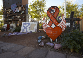
Decorations along the walkway at the Las Vegas Community Healing Garden, looking southeast in Las Vegas, Nevada: digital photograph
Date
Archival Collection
Description
Following the October 1, 2017 killing of 58 people at the Route 91 Harvest Music Festival on the Las Vegas Strip, the Las Vegas community responded in a variety of ways. Envisioned by activists and built by volunteers, the City of Las Vegas established the Las Vegas Community Healing Garden at 1015 S. Casino Center Boulevard to honor the victims and give family members and the community a place to gather to remember.
Image
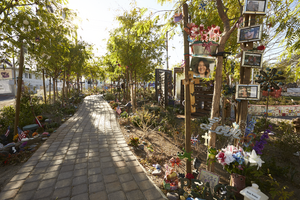

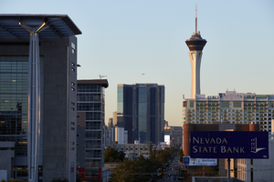
Fountainbleau Las Vegas at Sunrise, Las Vegas, Nevada: digital photograph
Date
Archival Collection
Description
Image

Fountainbleau Las Vegas at Sunrise, Las Vegas, Nevada: digital photograph
Date
Archival Collection
Description
Image
Fountainbleau Las Vegas at Sunrise, Las Vegas, Nevada: digital photograph
Date
Archival Collection
Description
Image
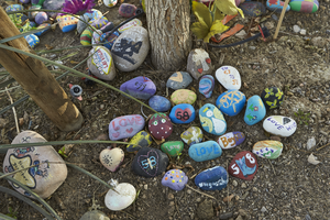
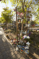
Hand painted stones at the Las Vegas Community Healing Garden, looking northeast in Las Vegas, Nevada: digital photograph
Date
Archival Collection
Description
Following the October 1, 2017 killing of 58 people at the Route 91 Harvest Music Festival on the Las Vegas Strip, the Las Vegas community responded in a variety of ways. Envisioned by activists and built by volunteers, the City of Las Vegas established the Las Vegas Community Healing Garden at 1015 S. Casino Center Boulevard to honor the victims and give family members and the community a place to gather to remember.
Image
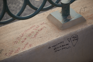
Writing on a fence base are part of the 1 October memorial located at the Welcome to Las Vegas, looking east-southeast in Las Vegas, Nevada: digital photograph
Date
Archival Collection
Description
Following the October 1, 2017 killing of 58 people at the Route 91 Harvest Music Festival on the Las Vegas Strip, the Las Vegas community responded in a variety of ways. This series of photographs document the impromptu memorial created at the Welcome to Las Vegas sign.
Image