Search the Special Collections and Archives Portal
Search Results
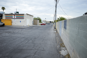
Alley behind businesses along West Sahara Avenue at South Arville Street looking east, Las Vegas, Nevada: digital photograph
Date
Archival Collection
Description
Image
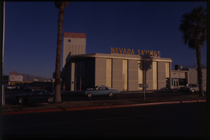
Color view of the Nevada Savings building, located at the South East corner of Charleston Boulevard and Maryland Parkway. The Huntridge Theater is visible in the background.
Date
Description
Image
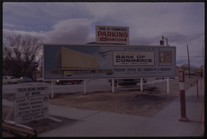
Color view of the construction sign for the Nevada Bank of Commerce building located at the North East corner of 4th Street and Bridger Avenue.
Date
Description
Image
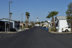
Central Drive and the Straosphere tower in the Maycliff Senior Mobile Home Part off East Sahara Avenue at Sandhill Road looking west, Las Vegas, Nevada: digital photograph
Date
Archival Collection
Description
Image
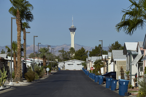
Central Drive and the Straosphere tower in the Maycliff Senior Mobile Home Part off East Sahara Avenue at Sandhill Road looking west, Las Vegas, Nevada: digital photograph
Date
Archival Collection
Description
Image
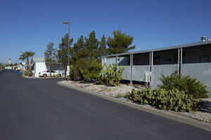
Central Drive and the Straosphere tower in the Maycliff Senior Mobile Home Part off East Sahara Avenue at Sandhill Road looking west, Las Vegas, Nevada: digital photograph
Date
Archival Collection
Description
Image
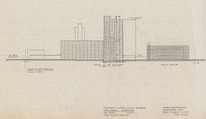
Architectural drawing of the Holiday Inn and Casino (Las Vegas), master plan, west to east section (Las Vegas), November 1, 1987
Date
Archival Collection
Description
Proposed master plan cross section of the Holiday Inn and Holiday Casino in Las Vegas. Original medium: pencil and ink on tracing paper. The property became Harrah's Las Vegas in 1992.
Site Name: Holiday Casino
Address: 3475 Las Vegas Boulevard South
Image
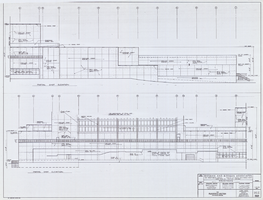
Architectural drawing of the Flamingo Hilton tower addition (Las Vegas), low-rise east exterior elevation, July 27, 1976
Date
Archival Collection
Description
Architectural plans for the addition of a tower to the Flamingo in 1976. Reduced sheet. Original material: parchment. Socoloske, Zelner and Associates, structural engineers; Harold L. Epstein and Associates, structural engineers; Bennett/Tepper, mechanical engineers; J. L. Cusick and Associates, electrical engineers.
Site Name: Flamingo Hotel and Casino
Address: 3555 Las Vegas Boulevard South
Image
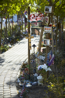
Decorations along the walkway at the Las Vegas Community Healing Garden, looking east-southeast in Las Vegas, Nevada: digital photograph
Date
Archival Collection
Description
Following the October 1, 2017 killing of 58 people at the Route 91 Harvest Music Festival on the Las Vegas Strip, the Las Vegas community responded in a variety of ways. Envisioned by activists and built by volunteers, the City of Las Vegas established the Las Vegas Community Healing Garden at 1015 S. Casino Center Boulevard to honor the victims and give family members and the community a place to gather to remember.
Image
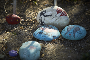
Hand painted stones at the Las Vegas Community Healing Garden, looking east-southeast in Las Vegas, Nevada: digital photograph
Date
Archival Collection
Description
Following the October 1, 2017 killing of 58 people at the Route 91 Harvest Music Festival on the Las Vegas Strip, the Las Vegas community responded in a variety of ways. Envisioned by activists and built by volunteers, the City of Las Vegas established the Las Vegas Community Healing Garden at 1015 S. Casino Center Boulevard to honor the victims and give family members and the community a place to gather to remember.
Image
