Search Results
County Accomplishments. Contains, by County, HWC accomplishments
Level of Description
File
Archival Collection
Howard Cannon Papers
To request this item in person:
Collection Number: MS-00002
Collection Name: Howard Cannon Papers
Box/Folder: Box 05 (Las Vegas files)
Collection Name: Howard Cannon Papers
Box/Folder: Box 05 (Las Vegas files)
Archival Component
Nye County county office remodel, 1991
Level of Description
File
Archival Collection
Alton Dean Jensen Architectural Records
To request this item in person:
Collection Number: MS-00843
Collection Name: Alton Dean Jensen Architectural Records
Box/Folder: Box 267
Collection Name: Alton Dean Jensen Architectural Records
Box/Folder: Box 267
Archival Component
Clark County, Nevada School District Annual Reports
Identifier
MS-00665
Abstract
The Clark County, Nevada School District Annual Reports include reports created by the Clark County School District from 1970 to 1980. Reports for the school years of 1972 to 1973, 1973 to 1974, and 1976 to 1977 are not included.
Archival Collection
Economic Opportunity Board of Clark County (Nev.): rosters, correspondence
Date
1964 to 1970
Archival Collection
Description
From the Clark County Economic Opportunity Board Records -- Series I. Administrative. This folder contains reports, correspondence, and rosters of the Economic Opportunity Board of Clark County, Nevada from 1964 through 1970.
Text

Map of Las Vegas and vicinity, Clark County, Nevada, November 1952
Date
1952-11
Description
'Copyright 1950. 3rd issue, November 1952.'
Image
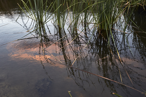
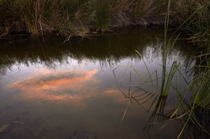
Clark County Wetlands Park, Clark County, Nevada: digital photograph
Date
2016-07-09
Archival Collection
Description
The sunset is reflected in a settling pond at the Clark County Wetlands Park.
Image
Clark County Wetlands Park, Clark County, Nevada: digital photograph
Date
2016-07-09
Archival Collection
Description
The sunset is reflected in a settling pond at the Clark County Wetlands Park.
Image
Clark County Wetlands Park, Clark County, Nevada: digital photograph
Date
2016-07-09
Archival Collection
Description
The sunset is reflected in a settling pond at the Clark County Wetlands Park.
Image
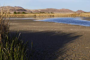
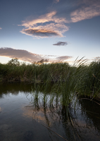
Clark County Wetlands Park, Clark County, Nevada: digital photograph
Date
2016-03-12
Archival Collection
Description
Water at the Clark County Wetlands Park rises and falls in settling ponds.
Image