Search the Special Collections and Archives Portal
Search Results
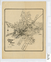
Map of Tonopah Mining District, Nye County, Nevada, circa 1903
Date
1899 to 1907
Description
Map showing mining claims in Tonopah Mining District, including areas owned by Tonopah Amalgamated Mining Co.; David Keith's Company of Salt Lake, Utah; Mispah Extension Company; Tonopah Mining Company of Nevada; Gold Hill Mining Co. Relief shown by hachures. Scale [ca. 1:7,200]. 1 in. equals 600 feet. Library's copy has some mines cross-hatched in pencil.
Image
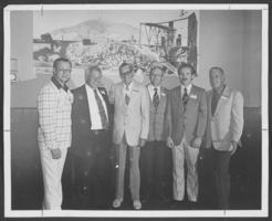
Photograph of members of the Nevada Judges Association, Clark County, Nevada, August 11, 1975
Date
1975-08-11
Archival Collection
Description
The members of the Nevada Judges Association in Clark County, Nevada. From left to right, the people pictured include: Al Gunderson, Supreme Court Justice; Tom Hickey, State Assemblyman from North Las Vegas; Warren Stanley, North Las Vegas Constable; Richard Bryan, Attorney General State of Nevada; Bill (?), Deputy D. A.; and Ray Daines, North Las Vegas Municipal Court Judge.
Image
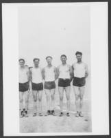
Photograph of basket ball team at Lincoln County High School, Panaca, Nevada, circa 1928
Date
1927 to 1929
Archival Collection
Description
Black and white photo of Lincoln County High School basketball team in Panaca. L-R: Lawrence Pace Nelson Blake (?), Rolf Butler, Ted Deck(?).
Image

Panoramic photograph of workers' housing at Reimers Lumber Mill, Douglas County, Nevada, circa 1900s
Date
1900 to 1909
Archival Collection
Description
Panoramic view of workers' housing located below Reimers Lumber Mill located near Glenbrook, Nevada in Douglas County, close to Lake Tahoe.
Image
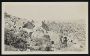
South view of Frenchman Flat, Nye County, Nevada: photographic print
Date
1910 (year approximate) to 1930 (year approximate)
Archival Collection
Description
From the Chester R. Longwell Photograph Collection (PH-00311). Massive volcanic (rhyolite) tuff, turned up along fault. North of wedge thrust bock south of Frenchman Flat. N IV-78.
Image
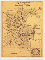
Map of Searchlight mining district, Clark County, Nevada, circa 1905
Date
1901 to 1909
Description
At bottom right of map: 'C.D. Baker, A.R. Thompson.' Title in lower right corner: 'Map of Searchlight mining district: mineral patents, water rights.' Logo of Nevada Engineering Construction Service, Inc., Las Vegas, Nev. in lower right corner. Blueline print. Shows mineral patents and water rights. Nevada Engineering & Construction Service, Inc.
Image
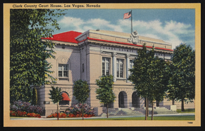
View of Clark County Courthouse located in Las Vegas, Nevada: postcard
Date
1900 (year approximate) to 1999 (year approximate)
Archival Collection
Description
From the UNLV Libraries Single Item Accession Photograph Collection (PH-00171)
Image
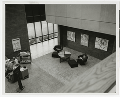
Photograph of Clark County Library District headquarters lobby, Las Vegas (Nev.), January 1974
Date
1974-01
Archival Collection
Description
Main lobby/gallery of the Clark County Library District headquarters on Flamingo Road. Patron, Henry Moody, and Pat Petty. Exhibit by F. Walbrack (spelling?) Street Address: Flamingo Road
Image
Clark County and Subarea Population Projections: An Update of Estimates Prepared for Use in Clark County's 208 Water Quality Management Plan by the Planning Information Corporation, 1990 April
Level of Description
File
Archival Collection
Clark County 208 Water Quality Management Plan Records
To request this item in person:
Collection Number: MS-00985
Collection Name: Clark County 208 Water Quality Management Plan Records
Box/Folder: Box 01
Collection Name: Clark County 208 Water Quality Management Plan Records
Box/Folder: Box 01
Archival Component
Clark County Clean Air Action Plan; An Action Plan to Improve the Air Around Us - 1994 Annual Report & 1995 Workplan by Clark County, approximately 1960 to 1980
Level of Description
File
Archival Collection
Clark County Planning Commission Research Library Collection
To request this item in person:
Collection Number: MS-01027
Collection Name: Clark County Planning Commission Research Library Collection
Box/Folder: Box 47
Collection Name: Clark County Planning Commission Research Library Collection
Box/Folder: Box 47
Archival Component
Pagination
Refine my results
Content Type
Creator or Contributor
Subject
Archival Collection
Digital Project
Resource Type
Year
Material Type
Place
Language
Records Classification
