Search the Special Collections and Archives Portal
Search Results
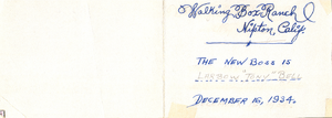
Reverse of postcard: Walking Box Ranch, Nipton, California
Date
Archival Collection
Description
From the Walking Box Ranch Photograph Collection (PH-00346). "Walking Box Ranch, Nipton, Calif. The new boss is Larbow 'Tony' Bell. December 16, 1934." is written on the postcard.
Text
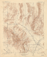
Topographic map of the Las Vegas Valley and surrounding northern and western mountain ranges, 1943
Date
Description
Text

Blueprint map showing proposed changes to water system, Las Vegas Land & Water Co., Las Vegas, Nevada, circa 1936
Date
Archival Collection
Description
Image
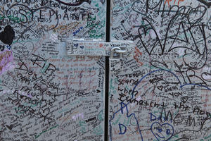
Messages, left as part of the 1 October memorial, cover a utility box near the Welcome to Las Vegas sign, looking east in Las Vegas, Nevada: digital photograph
Date
Archival Collection
Description
Following the October 1, 2017 killing of 58 people at the Route 91 Harvest Music Festival on the Las Vegas Strip, the Las Vegas community responded in a variety of ways. This series of photographs document the impromptu memorial created at the Welcome to Las Vegas sign.
Image
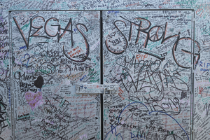
Messages, left as part of the 1 October memorial, cover a utility box near the Welcome to Las Vegas sign, looking east in Las Vegas, Nevada: digital photograph
Date
Archival Collection
Description
Following the October 1, 2017 killing of 58 people at the Route 91 Harvest Music Festival on the Las Vegas Strip, the Las Vegas community responded in a variety of ways. This series of photographs document the impromptu memorial created at the Welcome to Las Vegas sign.
Image
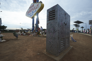
Messages, left as part of the 1 October memorial, cover a utility box near the Welcome to Las Vegas sign, looking southeast in Las Vegas, Nevada: digital photograph
Date
Archival Collection
Description
Following the October 1, 2017 killing of 58 people at the Route 91 Harvest Music Festival on the Las Vegas Strip, the Las Vegas community responded in a variety of ways. This series of photographs document the impromptu memorial created at the Welcome to Las Vegas sign.
Image
Richard Box, #14, University of Nevada, Las Vegas basketball player, 1979-1980
Level of Description
Archival Collection
Collection Name: University of Nevada, Las Vegas Creative Services Thematic Slides and Prints
Box/Folder: Box 111
Archival Component
Richard Box, #14, University of Nevada, Las Vegas basketball player, 1980-1981
Level of Description
Archival Collection
Collection Name: University of Nevada, Las Vegas Creative Services Thematic Slides and Prints
Box/Folder: Box 111
Archival Component
Richard Box, #14, University of Nevada, Las Vegas basketball player, 1981-1982
Level of Description
Archival Collection
Collection Name: University of Nevada, Las Vegas Creative Services Thematic Slides and Prints
Box/Folder: Box 111
Archival Component
Richard Box, #14, University of Nevada, Las Vegas basketball player, 1978-1979
Level of Description
Archival Collection
Collection Name: University of Nevada, Las Vegas Creative Services Thematic Slides and Prints
Box/Folder: Box 110
Archival Component
