Search Results
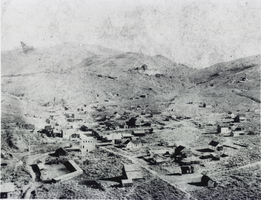
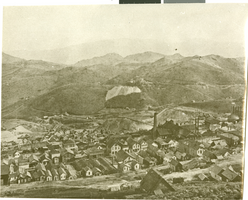
Aerial photograph of Aurora, Nevada, circa 1860s-1910s
Date
1860 to 1919
Archival Collection
Description
Aerial view of the mining town of Auora, Nevada, founded in 1860.
Image
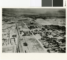
Aerial photograph of Las Vegas, 1915
Date
1915
Archival Collection
Description
Aerial view of Las Vegas in 1915.
Image
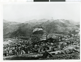
Aerial photograph of Virginia City, Nevada, 1870-1875
Date
1870 to 1875
Archival Collection
Description
A aerial view of Virginia City before the fire of 1875.
Image
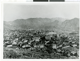
Aerial photograph of Virginia City, Nevada, 1870-1875
Date
1870 to 1875
Archival Collection
Description
A aerial view of Virginia City before the fire of 1875.
Image
Aerial photograph of Virginia City, Nevada, 1870-1875
Date
1870 to 1875
Archival Collection
Description
A aerial view of Virginia City before the fire of 1875.
Image
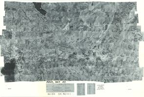
Index to aerial photographs of Reno, Nevada: photographic print
Date
1952 to 1954
Archival Collection
Description
From the Army Mapping Service Aerial Photographs of Southern and Western Nevada (PH-00285). Aerial photographs, composites, and indices. Geological Survey, Army Map Service. Western United States. Project No. 22502-569. Contract No. DA-49-018eng 1404. Lot BH. Sheet NJ 11-1.
Image
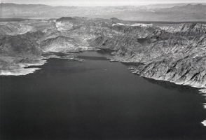
Aerial photograph of Lake Mead, circa 1935-1950
Date
1935 to 1950
Archival Collection
Description
An image showing an aerial view of Lake Mead.
Image
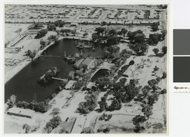
Aerial photograph of Lorenzi Park, 1965
Date
1965
Archival Collection
Description
Aerial view of Lorenzi Park.
Transcribed Notes: 'Written on back of photo: Twin Lakes area - aerial photo; Notes on attached sheet: 1965. Ken Jones, photographer, must be credited.'
Image
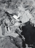
Aerial photograph of Hoover Dam, circa 1930-1949
Date
1930 to 1949
Archival Collection
Description
An aerial view of Hoover Dam.
Image
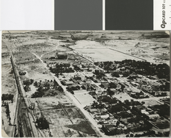
Aerial photograph of Las Vegas in the 1920s
Date
1920 (year uncertain)
Archival Collection
Description
Aerial photograph of Las Vegas looking north.
Transcribed Notes: Transcribed from photo sleeve: "Aerial views of Las Vegas showing downtown UP yards 1920's. Shop's still standing (1983)."
Image