Search Results
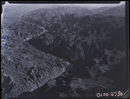
Film transparency of an aerial view of the Colorado River, circa 1930s
Date
1930 to 1939
Archival Collection
Description
Aerial view of the Colorado River printed on nitrate film.
Image
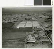
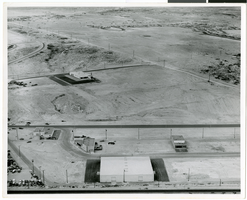
Aerial photograph of a farm in Las Vegas, 1964
Date
1964
Archival Collection
Description
Aerial view of a farm in the Las Vegas Valley.
Image
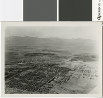
Aerial photograph of Las Vegas in the late 1920s
Date
1925 (year approximate)
Archival Collection
Description
Aerial view of Las Vegas, looking north.
Image
"Aerials" album, 1955-1988
Level of Description
File
Archival Collection
Blue Diamond History Committee Collection
To request this item in person:
Collection Number: MS-00727
Collection Name: Blue Diamond History Committee Collection
Box/Folder: Box 04
Collection Name: Blue Diamond History Committee Collection
Box/Folder: Box 04
Archival Component
MGM Grand aerial footage: video
Date
1995 (year approximate) to 2005 (year approximate)
Archival Collection
Description
Aerial and street-level B-roll of the MGM Grand at night and during the daytime. Original media BetacamSP, color, aspect ratio 4 x 3, frame size 720 x 486. From the UNLV TV Audiovisual Collection (UA-00098) – Digitized audiovisual material file.
Moving Image
Aerial of Goodsprings, Nevada, 1912
Level of Description
File
Archival Collection
Fayle Family Photographs
To request this item in person:
Collection Number: PH-00113
Collection Name: Fayle Family Photographs
Box/Folder: Flat File 01
Collection Name: Fayle Family Photographs
Box/Folder: Flat File 01
Archival Component
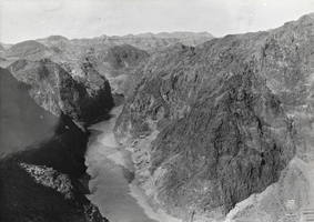
Aerial photograph of Boulder Canyon, Nevada, 1931
Date
1931
Archival Collection
Description
Aerial view of Boulder Canyon near Boulder City, Nevada, 1931.
Image
Circus Circus: Aerials, undated
Level of Description
File
Archival Collection
MGM Mirage Records on Mandalay Resort Group
To request this item in person:
Collection Number: MS-00511
Collection Name: MGM Mirage Records on Mandalay Resort Group
Box/Folder: Box 59
Collection Name: MGM Mirage Records on Mandalay Resort Group
Box/Folder: Box 59
Archival Component
Las Vegas Aerials, undated
Level of Description
File
Archival Collection
JMA Architecture Studio Records
To request this item in person:
Collection Number: MS-00783
Collection Name: JMA Architecture Studio Records
Box/Folder: Box 86
Collection Name: JMA Architecture Studio Records
Box/Folder: Box 86
Archival Component
Aerial photograph of North Las Vegas, Nevada, June 5, 1973
Date
1973-06-05
Archival Collection
Description
Aerial view of housing developments in North Las Vegas, Nevada. Handwritten on back of photograph: "Regal Estates. Losee Road, Crestline Loop."
Image