Search Results
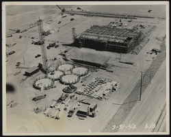
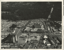
Photograph of aerial view of preparation plant construction, Henderson (Nev.), March 31, 1942
Date
Archival Collection
Description
Image
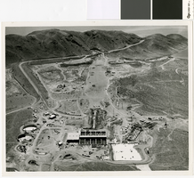
Aerial photograph of Las Vegas Valley Water Project, early phase, circa 1970
Date
Archival Collection
Description
Aerial view of the Las Vegas Valley Water Project. Construction might be part of the Leonard R. Fayle reservoir and pumping station
Image
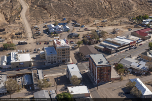
Aerial photo of downtown, including the Mizpah Hotel, in Tonopah, Nevada: digital photograph
Date
Archival Collection
Description
Photographer's assigned keywords: "CSP; Crescent Dunes; Mizpah Hotel; NV; Nevada; Solar Reserve; SolarReserve; Tonopah; aerial; green energy; off-site; renewable energy; town."
Image
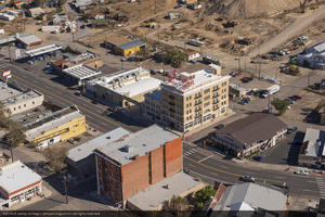
Aerial photo of downtown, including the Mizpah Hotel, in Tonopah, Nevada: digital photograph
Date
Archival Collection
Description
Photographer's assigned keywords: "CSP; Crescent Dunes; Mizpah Hotel; NV; Nevada; Solar Reserve; SolarReserve; Tonopah; aerial; green energy; off-site; renewable energy; town."
Image
Aerial photograph of Harrah's Tahoe and Harrah's Stateline Club (Stateline, Nev.), 1961
Date
Archival Collection
Description
Aerial view of Harrah's Stateline Club adjacent to Harvey's Tahoe (lower left of photo) and Harrah's Tahoe (center of photo) on either side of Highway 50. Handwritten on original: "Air view 1961."
Site Name: Harrah's Tahoe
Address: 15 Highway 50
Image
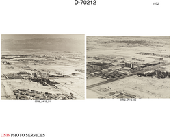
Aerial view of UNLV campus circa 1972: digital photographs
Date
Archival Collection
Description
Image
Aerial photograph of Boulder City, Nevada, 1974 August 18
Level of Description
Archival Collection
Collection Name: Elton and Madelaine Garrett Photograph and Architectural Drawing Collection
Box/Folder: Oversized Box SH-063
Archival Component
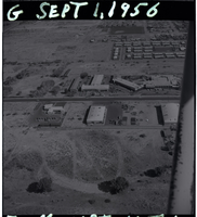
Film negative aerial views of Moulin Rouge Hotel and Casino, September 1, 1956
Date
Description
Series of eleven black and white negative aerial views of Moulin Rouge Hotel and Casino and Montmartre Motel, dated September 1, 1956.
Image
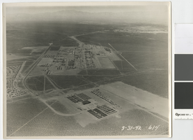
Aerial photograph of the Basic Magnesium Inc. plant, Henderson, Nevada, March 31, 1942
Date
Archival Collection
Description
Aerial view of the Basic Magnesium plant looking west over the Las Vegas Valley towards the Spring Mountains.
Image
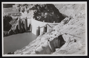
Photograph of aerial lakeside view of Hoover Dam, 1937-1938
Date
Archival Collection
Description
Image