Search Results

Map of Boulder Dam area and Las Vegas, Nevada, October 7, 1930
Date
Description
Text
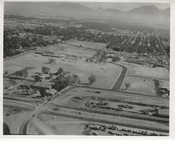
Aerial photograph of the Rose Garden Urban Renewal Project, North Las Vegas, circa October 1970
Date
Archival Collection
Description
Image
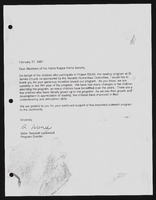
Alpha Kappa Alpha Sorority Project Read letter
Date
Archival Collection
Description
From the Alpha Kappa Alpha Sorority, Incorporated, Theta Theta Omega Chapter Records (MS-01014) -- Chapter records file.
Text
Unconfined Compression Experiments on Topopah Spring Member Tuff at 22(Degrees) Cand A. - Sandia Report, Yucca Mountain Site Characterization Project, 1993 August
Level of Description
Archival Collection
Collection Name: Yucca Mountain Site Characterization Office Collection
Box/Folder: Box 91
Archival Component

KLVX TV - Project Innovate Research Papers
Identifier
Abstract
The collection is comprised of original research material on KLVX TV's "Project Innovate," a cooperative project with the Clark County, Nevada School District. The materials were collected and created by Ira G. Kimball for his 1988 University of Nevada, Las Vegas, Master's thesis.
Archival Collection
Film transparency of Las Vegas High School, Las Vegas, February 22, 1930
Date
Archival Collection
Description
Image
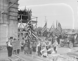
County agent project progress report, Flood control, November 1, 1941
Date
Archival Collection
Description
Report of the 1941 activities in the Clark County's Flood Control Program in overcoming the flood menace in the Las Vegas, Moapa, and Virgin Valleys. Project Number: State Office No. 172. Clark County No. 12
Text