Search the Special Collections and Archives Portal

Search Results

Display    Results Per Page
Displaying results 1 - 10 of 650522

Southern Nevada Jewish Heritage Project Web Archive

Identifier

MS-01045

Abstract

The Southern Nevada Jewish Heritage Project Web Archive contains archived websites that were captured between 2016 to 2018 that are related to UNLV University Libraries community documentation project, the Southern Nevada Jewish Heritage Project. Archived websites of religious institutions and community organizations are primarily represented. The collection also includes archived websites of organizations such as Jewish Nevada, Jewish Family Service Agency, the Las Vegas Jewish Film Festival, and David Magazine. Archived websites for religious institutions include synagogues such as Temple Beth Sholom, Congregation Ner Tamid, Temple Bet Knesset Bamidbar, and Pnai Tikvah.

Archival Collection

Club Histories and Archives Project, 1987

Level of Description

File

Archival Collection

Nevada Federation of Women's Clubs Records
To request this item in person:
Collection Number: MS-00266
Collection Name: Nevada Federation of Women's Clubs Records
Box/Folder: Box 04

Archival Component

Security Archives: project manager documents, 1987

Level of Description

File

Archival Collection

J. A. Tiberti Construction Records
To request this item in person:
Collection Number: MS-00855
Collection Name: J. A. Tiberti Construction Records
Box/Folder: Box 097

Archival Component

Building Las Vegas Web Archive

Identifier

MS-01044

Abstract

The Building Las Vegas Web Archive is comprised of archived websites captured in 2017 that are related to UNLV University Libraries documentation project, Building Las Vegas. Archived websites represent architecture firms, construction companies, and housing developers in the Las Vegas Valley. This collection includes websites for organizations such as Mark L. Fine & Associates, Klai Juba Wald Architecture, Southern Nevada Home Builders Association, and AIA Las Vegas.

Archival Collection

"Memorial for Queer Rhyolite" project webpage: archived website, 2021

Level of Description

Other Level

Archival Collection

<em render="italic">Memorial for Queer Rhyolite</em> Papers
To request this item in person:
Collection Number: MS-01067
Collection Name: Memorial for Queer Rhyolite Papers
Box/Folder: N/A

Archival Component

#05080: Business of Murder - Archive, 1983 September 22

Level of Description

File

Archival Collection

University of Nevada, Las Vegas Creative Services Records (1980s)
To request this item in person:
Collection Number: PH-00388-02
Collection Name: University of Nevada, Las Vegas Creative Services Records (1980s)
Box/Folder: N/A

Archival Component
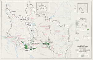
Map of Region 3 projects, Arizona-California-Nevada-New Mexico-Utah, September 1967

Date

1967-09

Description

25 x 39 cm. United States, Department of the Interior, Bureau of Reclamation. Relief shown pictorially. "Map no. X-300-738." "September 1967." Shows completed, under construction and proposed dams and reservoirs, canals, and aqueducts, power plants, pumping plants, substations, transmission lines, tunnels and siphons. Also shows non-Bureau of Reclamation dams, reservoirs, tunnels, pipelines and irrigated lands. Includes inset map of location of Region 3 and key map of drainage basins. Original Publisher: Interior.

Image

#57089: Parenting Project, 1987 October 22

Level of Description

File

Archival Collection

University of Nevada, Las Vegas Creative Services Records (1980s)
To request this item in person:
Collection Number: PH-00388-02
Collection Name: University of Nevada, Las Vegas Creative Services Records (1980s)
Box/Folder: N/A

Archival Component
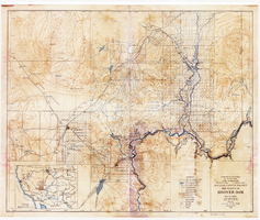
Topographic map of Boulder Canyon Project, Hoover Dam area, 1932

Date

1932

Description

Scale [ca. 1:221,760. 1 in. to approx. 3.5 miles] ; 1 map : col. ; 51 x 62 cm ; Relief shown by contours and spot heights ; "Prepared in Washington Office from compilation made in Las Vegas Office." ; "Map no. 24000." ; Includes township and range grid ; Shows power lines, triangulation stations, boundary monuments, roads, telephone lines, mines, bench marks, etc. ; Department of the Interior, Bureau of Reclamation.

Image

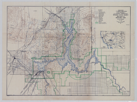
Topographic map of Boulder Canyon Project, Boulder Dam area, 1940

Date

1940

Description

Scale [ca. 1:221,760. 1 in. to approx. 3.5 miles] ; 1 map : col. ; 51 x 71 cm ; Relief shown by contours and spot heights ; Includes township and range grid ; "Map no. 40-40" ; Includes index map ; Shows power lines, triangulation stations, boundary monuments, roads, telephone lines, mines, bench marks, etc. ; U.S. Dept. of the Interior, Bureau of Reclamation

Image