Search Results

Macayo Vegas Restaurant in Las Vegas, Nevada: postcard
Date
Archival Collection
Description
Image
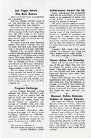
The Wheel Las Vegas Rotary Club newsletter, 1960s-1970s
Date
Archival Collection
Description
Text
Wynn Las Vegas Scrapbook
Identifier
Abstract
The collection consists of one scrapbook (2008) of postcards and photographs tracing the history of the Las Vegas property upon which the Wynn Las Vegas resort was built and four magazines featuring articles about Las Vegas (1940, 1947, 1955, and 1959). The scrapbook begins with several pages of historic postcards of the hotel originally built on the property, the Desert Inn, and continues with the establishment of the Wynn and the vision of its associated resort, the Encore. While the images primarily focus on the Desert Inn and the Wynn, there are also several pages of images of various other Las Vegas Strip properties accompanied by a brief timeline. The scrapbook contains approximately 76 images, dating from 1950 to 2008.
Archival Collection
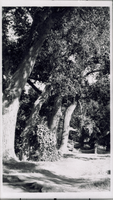
Transparency of Las Vegas Ranch, Las Vegas, circa early 1900s
Date
Archival Collection
Description
Image
Transparency of Las Vegas Ranch, Las Vegas, circa early 1900s
Date
Archival Collection
Description
Image
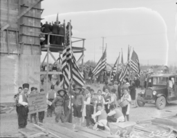
Film transparency of Las Vegas High School, Las Vegas, February 22, 1930
Date
Archival Collection
Description
Image
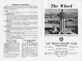
The Wheel Las Vegas Rotary Club newsletter, June 5, 1975
Date
Archival Collection
Description
Text
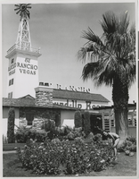
Photograph of the front of El Rancho Vegas (Las Vegas), 1950s
Date
Archival Collection
Description
The front of the El Rancho Vegas with a woman in a bikini. Stamp on back of photo: "Please credit Union Pacific Railroad Photo."
Site Name: El Rancho Vegas
Address: 2500 Las Vegas Boulevard South
Image
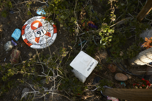
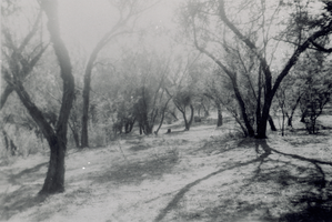
Decorations at the Las Vegas Community Healing Garden, looking west-northwest in Las Vegas, Nevada: digital photograph
Date
Archival Collection
Description
Following the October 1, 2017 killing of 58 people at the Route 91 Harvest Music Festival on the Las Vegas Strip, the Las Vegas community responded in a variety of ways. Envisioned by activists and built by volunteers, the City of Las Vegas established the Las Vegas Community Healing Garden at 1015 S. Casino Center Boulevard to honor the victims and give family members and the community a place to gather to remember.
Image
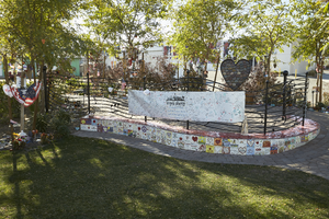
Landscaping at the Las Vegas Community Healing Garden, looking south-southeast in Las Vegas, Nevada: digital photograph
Date
Archival Collection
Description
Following the October 1, 2017 killing of 58 people at the Route 91 Harvest Music Festival on the Las Vegas Strip, the Las Vegas community responded in a variety of ways. Envisioned by activists and built by volunteers, the City of Las Vegas established the Las Vegas Community Healing Garden at 1015 S. Casino Center Boulevard to honor the victims and give family members and the community a place to gather to remember.
Image