Search the Special Collections and Archives Portal
Search Results
Bob Stupak interview and aerial views of Vegas World: video
Date
Archival Collection
Description
Raw video footage of interview with Bob Stupak and helicopter aerial views of Vegas World; along with some cutaway aerial views of the surrounding neighborhood and other Strip properties. Video starts @:19 with Stupak makeup prepping, followed by interview where Stupak covers a range of subjects; touting the amenities of Vegas World Hotel and Casino; with tips on successful gambling. @13: 28 to 54:28 is arrival of helicopter and aerial views of Vegas World and nearby areas. Video content ends @54:28. Original media VHS, color, aspect ratio 4 x 3, frame size 720 x 486. From the Bob Stupak Professional Papers (MS-01016) -- Professional papers -- Audiovisual material -- Digitized audiovisual material file.
Moving Image
Bob Stupak to publish "Las Vegas Bullet" newspaper: video
Date
Archival Collection
Description
Local news anchors discuss Bob Stupak's newspaper business "Las Vegas Bullet" a 36-page paper; interview clip with Stupak discussing the paper being an alternative news source for the city, as well as Stupka's upcoming role in a film titled "Bloody Mary"; clip shows Stupak briefly arguing with Ron Lurie supporters after losing mayoral race, will include editorial columns by Stupak and Steve Miller. Original media VHS, color, aspect ratio 4 x 3, frame size 720 x 486. From the Bob Stupak Professional Papers (MS-01016) -- Professional papers -- Audiovisual material -- Digitized audiovisual clips file.
Moving Image
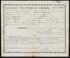
Marriage certificate of Helen and Frank Stewart and Tiza Stewart land patents
Date
Archival Collection
Description
Marriage certificate of Helen and Frank Stewart and Tiza Stewart land patents
Text
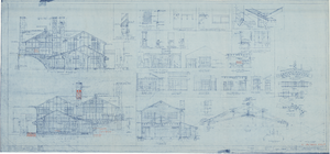
Architectural drawing of additions to pavilion at Zion National Park, Utah, elevations, sections and details, February 2, 1926
Date
Description
North and south exterior elevations, numerous sections, details, plans, and diagrams for pavilion building at Zion National Park, Utah, including north and south wing additons. Scales as shown. "Dr. by D.A.E., P.R.G., W.L.H." "As constructed. 15782-F. Sheet no. 6. Job no. 348. Date 12/12/25." "Recommended by D.R. Hull per T.C. Unit, Landscape Eng. N.P.S. Approved by Stephen T. Mather, Director, N.P.S." "Rev. 1/11/26, 2/2/26."
Site Name: Zion National Park (Utah)
Image
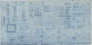
Architectural drawing of additions to pavilion at Zion National Park, Utah,details, February 2, 1926
Date
Description
Detail drawings of additions to pavilion building and surrounding area, Zion National Park, Utah. Scale as shown. "Dr. by P.R.G., N.D.B." "As constructed. 15782-H. Sheet no. 8. Job no. 348. Date 12/12/25." "Recommended by D.R. Hull per T.C. Unit, Landscape Eng. N.P.S. Approved by Stephen T. Mather, Director, N.P.S." "Rev. 1/11/26, 2/2/26."
Site Name: Zion National Park (Utah)
Image
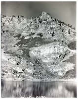
Film transparency of Angel Lake, Nevada, November 10, 1976
Date
Archival Collection
Description
Image
Ward Lindquist Photograph Collection on Lake Mead
Identifier
Abstract
The Ward Lindquist Photograph Collection on Lake Mead (approximately 1945-1956) contains black-and-white photographic prints and negatives primarily from Hoover Dam and Lake Mead, both located in both Arizona and Nevada. The images depict recreational activities at Lake Mead, namely fishing, swimming, boating, and camping. The remaining images depict the exterior and interior of Hoover Dam, as well as nature and wildlife in southern Nevada.
Archival Collection

