Search the Special Collections and Archives Portal
Search Results
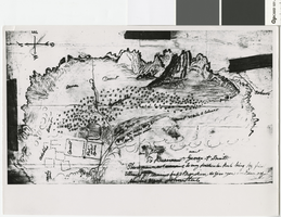
Hand-drawn map of the Mormon Fort and Las Vegas Valley from a letter by John Steele to Brigham Young, circa 1855
Date
1850 to 1859
Archival Collection
Description
Hand-drawn map showing area around the Mormon Fort in Las Vegas, Nevada, circa 1855. Handwritten in lower right: 'To President George A. Smith. This is drawn not according to any particular rule being my first attempt at drawing but it may serve to give you an idea of the Las Vegas. John Steele.' Copy print of material in LDS Archives. Scale not given..
Image
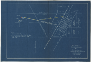
Blueprint map showing proposed changes to water system, Las Vegas Land & Water Co., Las Vegas, Nevada, circa 1936
Date
1931 to 1941
Archival Collection
Description
'U.P.C. Co. #1799.31-T3-L3.'
Image
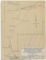
Map showing location of proposed 12-inch water main to connect Well #8 with settling basin serving Reservoir No. 2 at Las Vegas, Nevada, January 16, 1950
Date
1950-01-16
Archival Collection
Description
'Office of Manager-Industrial Development, Los Angeles, California.' Scale: 1" = 600'. 10 3/8 in. x 8 in.
Image
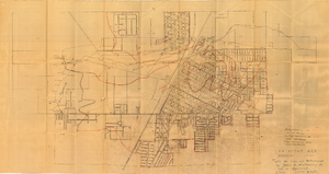
Map of Las Vegas, Nevada, annotated to show different soil types, September 2, 1948
Date
1948-09-02
Archival Collection
Description
'Types of soil as determined by James M. Montgomery for use in appraisal. (Copy). LRM 7/10/52'--handwritten in blue pencil in lower right corner of map. 'September 2, 1947. Revised September 2, 1948.' Soil was designated as badly corrosive, mildly corrosive, or non-corrosive by hand-drawn colored lines and hand-printed labels. Soil was surveyed to measure its effect on water pipes. Scale [ca. 1:7,200] 1 in.=600 feet.
Image
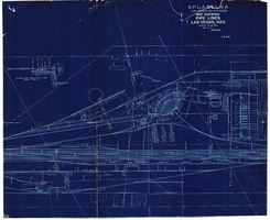
Map showing water pipelines, Las Vegas, Nevada, January 15, 1914
Date
1914-01-15
Archival Collection
Description
'S.P.L.A.&S.L.R.R., Los Angeles Division.' 'Jan. 15, 1914.' Includes other parts of water utilities besides pipelines such as sump pumps and water tanks. Scale varies. Blueprint. Library's copy includes hand-written notes.
Image
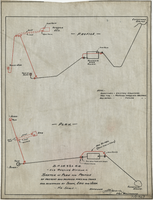
Sketch of plan and profile of present and proposed pipes and tanks and reservoirs at Sloan, Erie and Jean, Nevada, circa 1910s-1920s
Date
1910 to 1929
Archival Collection
Description
'No scale. Approved E.M. Jessup, Engr. Maintenance. 7-R-463.'
Image
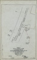
Map showing water connection for T. W. Sloan & Co., Moapa, Nevada, December 28, 1914
Date
1914-12-28
Archival Collection
Description
'Exhibit A.' 'S.P.L.A.&.S.L.R.R., Los Angeles Division.' 'Dec. 28, 1914.' 'Approved, [signed] E.M. Jessup, E.M. of W.' '2-T-168A' hand-printed in lower right corner. Scale: 1 in. = 100 ft.
Image
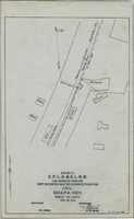
Map showing water connection for jail, Moapa, Nevada, December 28, 1914
Date
1914-12-28
Archival Collection
Description
'Exhibit A.' 'S.P.L.A.&.S.L.R.R., Los Angeles Division.' 'Approved, [signed] E.M. Jessup, E. M. of W.' 2-T-167A' hand-printed in lower right corner. Scale: 1 in. = 100 ft.
Image
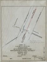
Map to accompany water contract, Enterprise School District, Arden, Nevada, September 1919
Date
1919
Archival Collection
Description
'Exhibit A. L.A. & S.L. R.R. Co., Los Angeles Division. Sept. 1919.' 'Approved [signed], C.F. Miller, Div. Engr.' 'I-W-67" hand-printed in lower right corner. 'Cancelled June 1st, 1920; Supts. file 129 - June 7th, 1920" handwritten on map. Scale: 1 in. : 100 ft.
Image
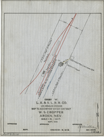
Map to accompany water contract, W. S. Cropper, Arden, Nevada, September 1919
Date
1919-09
Archival Collection
Description
'Exhibit A. L.A. & S.L. R.R. Co., Los Angeles Division. Sept. 1919. 'Approved [signed] C.F. Miller, Div. Engr.' 'I-W-68' hand-printed in lower right corner. 'Audit No 3114" hand-printed in lower left margin. Scale 1 in. = 100 ft.
Image
Pagination
Refine my results
Content Type
Creator or Contributor
Subject
Archival Collection
Digital Project
Resource Type
Year
Material Type
Place
Language
Records Classification
