Search the Special Collections and Archives Portal
Search Results
Project Long Shot Technical Operations Plan, 1965 October 22
Level of Description
File
Archival Collection
Edward Halligan Papers
Pagination
- Previous page ‹‹
- Page 14
Archival Component
Oral history project files: correspondence, photographs, publicity, and transcript drafts, 1995-2015
Level of Description
File
Archival Collection
Women's Research Institute of Nevada (WRIN) Oral History Records
Pagination
- Previous page ‹‹
- Page 14
Archival Component

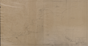
Map of general plan for the Wells Siding Project in Logandale, Nevada, May 15, 1935
Date
1935-05-15
Archival Collection
Description
'U.S. Department of Agriculture, Forest Service, Camp P.E. 206.' 'By C.C.C. Company, 538. Drawn by Ed Overton. Approved ... 5-15-35.Traced by Ed Overton.'
Image

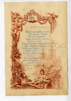
Savoy, dinner, May 22, 1897
Date
1897-05-22
Archival Collection
Description
Note: Handwritten menu; "P. Aug. Masse inv. et sc." written at the bottom of the illustration Restaurant: Savoy Hotel & Restaurant Location: London, England
Text
3-D Migration Experiment, Report 4 - Stripa Project 87-22, 1987 November
Level of Description
File
Archival Collection
Yucca Mountain Site Characterization Office Collection
Pagination
- Previous page ‹‹
- Page 14
Archival Component
Correspondence, memoranda, and clippings: Oral History of Nurses in Southern Nevada Project, 1996-2008
Level of Description
File
Archival Collection
Patricia van Betten Healthcare and Nursing Papers
Pagination
- Previous page ‹‹
- Page 14
Archival Component
#66321: Nevada Test Site Oral History Project Reception, 2008 April 27
Level of Description
File
Archival Collection
University of Nevada, Las Vegas Creative Services Records (2000s)
Pagination
- Previous page ‹‹
- Page 14
Archival Component
#71259: Sean Clark, associate dean for research and sponsored projects on November 22, 2016, 2016 November 22
Level of Description
Item
Archival Collection
University of Nevada, Las Vegas Creative Services Records (2010s)
Pagination
- Previous page ‹‹
- Page 14
Archival Component

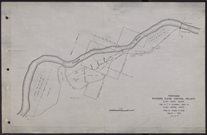
Map of proposed flood control project on the Virgin River in Clark County, Nevada, March, 1934
Date
1934-03
Archival Collection
Description
'Map no. 7 to accompany report on flood control survey. Made by Graham S. Quate. March 1934. Drawn by T.K.' Scale [ca. 1:15, 600. 1 in.=approx. 1,300 feet]. Relief shown by hachures. North oriented to upper right corner. Library's copy has hand-drawn map and notes in pencil on verso.
Image
Valley Bank-Tonopah, Nevada branch, project 06905, 1982 January 22
Level of Description
File
Archival Collection
Martin Stern Architectural Records
Pagination
- Previous page ‹‹
- Page 14
Archival Component
Pagination
Refine my results
Content Type
Creator or Contributor
Subject
Archival Collection
Digital Project
Resource Type
Year
Material Type
Place
Language
Records Classification
