Search Results

General geologic map of Las Vegas, Pahrump, and Indian Spring Valleys, Clark and Nye Counties, Nevada, 1948
Date
Description
At top of map: 'United States Department of the Interior, Geological Survey. State Engineer of Nevada. Water resources bulletin No. 5, Plate 1.' Relief shown by spot heights. Includes 3 inset maps of wells and springs in the vicinity of Pahrump, Manse Ranch and Indian Springs, Nevada. Scale [ca. 1:126,720. 1 inch to approx. 2 miles] (W 116°--W 115°/N 40°--N 36°). Originally published as plate 1 in Geology and water resources of Las Vegas, Pahrump, and Indian Spring Valleys, Clark and Nye Counties, Nevada by George B. Maxey and C.H. Jameson (1948), which is number 5 of the Water resources bulletin published by the Nevada Office of the State Engineer.
Image

Main Street, Goldfield, Nevada, postcard
Description
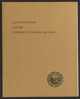
Law School Study for the University of Nevada, Las Vegas (bound)
Date
Archival Collection
Description
A bound version of the "Law School Study for the University of Nevada, Las Vegas" by Dean Willard H. Pedrick, College of Law, Arizona State University, and Professor Lorne Seidman, Chairman, Department of Finance, College of Business and Economics, University of Nevada, Las Vegas. From the University of Nevada, Las Vegas William S. Boyd School of Law Records (UA-00048).
Text
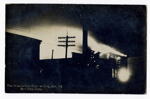
Fire in Goldfield, Nevada: postcard
Date
Archival Collection
Description
Image

Topographic map of Nevada-California, Las Vegas quadrangle, 1951
Date
Description
Image

Photograph of Jean Nevada Fayle and her mother, 1912
Date
Archival Collection
Description
Image
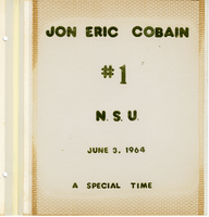
Jon E. Cobain Nevada Southern University graduation scrapbook
Date
Archival Collection
Description
Jon Eric Cobain's scrapbook with photographs, articles, and items from the June 3, 1964 first graduation of Nevada Southern University (later UNLV).
Mixed Content

Nevada Club wall mounted signs, Ely, Nevada
Date
Archival Collection
Description
Day and night views of the sign for the Nevada Club, a part of Hotel Nevada. The miner is unlit at night.
501 E Aultman St, Ely, NV 89301
Image

Map showing location of the Las Vegas & Tonopah Railroad from Las Vegas to Bullfrog, Nevada, 1906
Date
Archival Collection
Description
Image

Geologic map of the Plutonium Valley quadrangle, Nye and Lincoln counties, Nevada, 1965
Date
Description
Image