Search Results
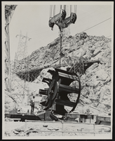
Nevada Cableway landing at the Hoover Dam: photographic print
Date
Archival Collection
Description
Image
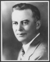
Photograph of Morley Griswold, Nevada, December 31, 1934
Date
Archival Collection
Description
Image
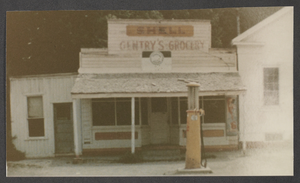
Photograph of Gentry's Grocery, Panaca, Nevada, circa 1960
Date
Archival Collection
Description
Image
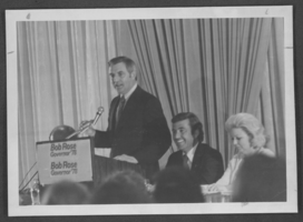
Photograph of Walter F. Mondale and Bob Rose, Nevada, 1978
Date
Archival Collection
Description
Image

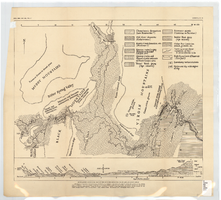
Surficial geologic map of Las Vegas Valley, Nevada, circa 1981
Date
Description
84-130. Originally published as plate 1 of Ground-water conditions in Las Vegas Valley, Clark County, Nevada. Part I. Hydrogeologic framework / by Russell W. Plume, published by the U.S. Geological Survey in 1984 as Open-file report 84-130.
Image
Generalized geological map of the Boulder Reservoir floor and adjacent areas, 1936
Date
Archival Collection
Description
Image
Letter and envelope from John M. Bunker, Eldorado Canyon, Nevada to Mary Etta Syphus, Panaca, Nevada
Date
Archival Collection
Description
From the Syphus-Bunker Papers (MS-00169). The folder contains an original handwritten letter, a typed transcription of the same letter, and the original envelope with the stamp removed, and a copy of the original letter.
Text
Letter and envelope from Mary Etta Syphus, Panaca, Nevada to John M. Bunker, Eldorado Canyon, Nevada
Date
Archival Collection
Description
From the Syphus-Bunker Papers (MS-00169). The folder contains an original handwritten letter, a typed transcription of the same letter, the original envelope but with no stamp or postmark, and a copy of the original letter.
Text
Interior of the railroad depot at Rhyolite, Nevada: photographic print
Date
Archival Collection
Description
From the Nye County, Nevada Photograph Collection (PH-00221) -- Series III. Beatty, Nevada -- Subseries III.C. Revert Family. Mr. Heisler, who, with his wife, ran the depot for many years, and Art Revert is leaning on the back of the chair (identified from left to right).
Image
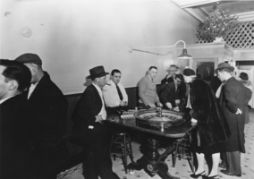
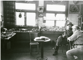
Interior of the Ace Club, Tonopah, Nevada: photographic print
Date
Archival Collection
Description
From the Nye County, Nevada Photograph Collection (PH-00221) -- Series VI. Tonopah, Nevada -- Subseries VI.F. Potts-Cirac Family. Louis Cirac, wearing the sweater, father of Jeanne Cirac Potts, is dealing roulette. The man to his right, ranking in chips, was named Palooka.
Image