Search Results
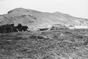
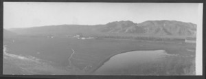
Horses at the Resting Spring Ranch, Nevada: photographic print
Date
1910 (year approximate) to 1950 (year approximate)
Archival Collection
Description
From the Nye County, Nevada Photograph Collection (PH-00221) -- Series IV. Pahrump, Nevada -- Subseries IV.G. Brown Family (Tecopa-Pahrump)
Image
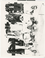
Photograph of members of Central Nevada Cattlemen's Association (Nev.), 1960-1980
Date
1960 to 1980
Archival Collection
Description
Left to right, front row: 1, 2) Members of Central Nevada Cattlemen's Association; 3) Mrs. Fellini. Second row: 3) Wayne Hage.
Image
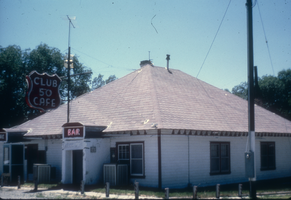
Slide of the Club 50 Cafe, McGill, Nevada, 1986
Date
1986
Archival Collection
Description
An image of the exterior of Club 50 Cafe, located on Highway 93 outside of Ely in McGill, Nevada. The red neon signs hanging off of the building read: "Club 50 Cafe; Bar."
Image
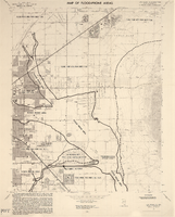
Maps of flood-prone areas in Las Vegas, Nevada, 1973
Date
1973
Description
'Prepared by the U.S. Department of the Interior, Geological Survey, in cooperation with the U.S. Department of Housing and Urban Development, Federal Insurance Administration. 1973.' Sheet 1: Las Vegas NE, Nev.; Sheet 2: Las Vegas SE, Nev.; Sheet 3:Las Vegas SW, Nev.; Sheet 4: Las Vegas NW, Nev. Published by Geological Survey (U.S.). Scale 1:24,000. [1 in. to approx. 2,000 ft.]. Relief shown by contours. Flood information overprinted on U.S. Geological Survey 7.5 minute topographic quadrangles: [sheet 1] Las Vegas NE quadrangle, [sheet 2] Las Vegas SE quadrangle, [sheet 3] Las Vegas SW quadrangle, [sheet 4] Las Vegas NW quadrangle, 1967. Shows areas subject to flooding by a flood that has 1 in 100 chance on the average of occurring in any one year. "Flood boundaries were estimated from: regional stage-frequency relations." Includes notes.
Image
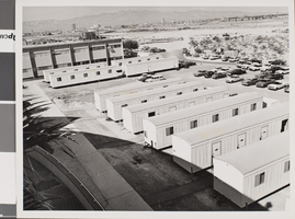
Photograph of Nevada Southern University, circa 1960s-1970s
Date
1960 to 1975
Archival Collection
Description
The Laboratory and Faculty trailers at Nevada Southern University.
Image
Brief of freight weights in Nevada for the Interstate Commerce Commission and Supreme Court of Nevada brief of Appellant State of Nevada vs. Tonopah Extension Mining Company, 1914
Level of Description
File
Archival Collection
Hugh H. Brown Papers
To request this item in person:
Collection Number: MS-00883
Collection Name: Hugh H. Brown Papers
Box/Folder: Box 01
Collection Name: Hugh H. Brown Papers
Box/Folder: Box 01
Archival Component
Correspondence, inquiries from Washington D.C. about Nevada delegates to the DNC, attendance at Nevada State Democratic Convention, Nevada State Democratic Party, 1971 to 1972
Level of Description
File
Archival Collection
Phil Carlino Papers
To request this item in person:
Collection Number: MS-00953
Collection Name: Phil Carlino Papers
Box/Folder: Box 03
Collection Name: Phil Carlino Papers
Box/Folder: Box 03
Archival Component
Postcard of train, Lincoln County, Nevada, circa 1890's
Date
1890 to 1899
Archival Collection
Description
View of countryside and train, Lincoln County, Nevada
Image
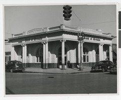
Photograph of Bank of Nevada, Las Vegas (Nev.), 1941
Date
1941
Archival Collection
Description
Original Bank of Nevada at 1st St & Carson Ave, 1941. Bank of Nevada bought the First State Bank. Site Name: Bank of Nevada (building) (Las Vegas, Nev.) Street Address: East Carson Avenue & South 1 Street
Image

Paseo Verde Drive, Henderson, Nevada: digital photograph
Date
2018-02-03
Archival Collection
Description
Trails and sidewalks are integrated into the community monuments and rest spaces along Paseo Verde Parkway near Valle Verde Drive in Henderson, Nevada.
Image