Search Results
Nevada Resort Association Records
Identifier
Abstract
The records are comprised of subject files and reports from approximately the 1990s to the 2000s related to data gathering and lobbying activities of the Nevada Resort Association. Materials include drafts of legislation related to gaming, tax reports, health and safety regulations, labor and employment matters, and zoning issues.
Archival Collection

Nevada Library Notes
Date
Description
Nevada Library Notes, Vol. 9-10 issued by the Nevada State Library. Materials about the news of library activities and articles for publication by Nevada librarians. It also contains the Nevada Library Association directory issue from 1971 to 1973.
Text
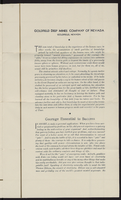
Goldfield Deep Mines Company of Nevada Pamphlet
Description
Text

Blueprint map showing proposed new 12" well and pipe line changes at water springs, Las Vegas, Nevada, circa 1920
Date
Archival Collection
Description
Image
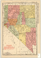
Map of Nevada Railroads, 1904
Date
Description
Image

Map of California, Utah, Nevada, Colorado, New Mexico and Arizona, circa 1867
Date
Description
Image
Album 6: scenes in Southern Nevada, including the Kiel Ranch, Rhyolite, Nevada, and Thomas, Nevada: photographic prints
Date
Archival Collection
Description
Image
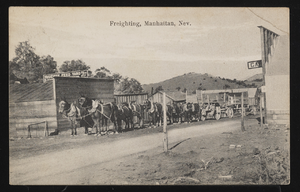
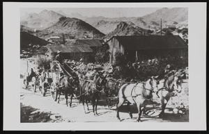
Freighting in Manhattan, Nevada: postcard
Date
Archival Collection
Description
Image
Stowell Whitney freighting out of Goodsprings, Nevada: photographic print
Date
Archival Collection
Description
Image
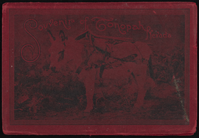
"Souvenir of Tonopah, Nevada" with photos from Goldfield, Tonopah, and Searchlight, Nevada: photograph album
Date
Archival Collection
Description
Image