Search the Special Collections and Archives Portal
Search Results
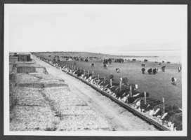
Photograph of feed troughs, Diamond Valley, California, circa early to mid 1900s
Date
1900 to 1959
Archival Collection
Description
Harvey Sewell and his daughter Dorothy's feeding troughs in Diamond Valley, California.
Image

Photograph of Union Pacific Railroad yards, circa early to mid 1900s
Date
1900 to 1969
Archival Collection
Description
A view of the Union Pacific Railroad yards.
Image
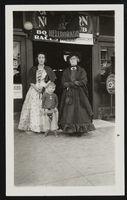
Photograph of Stocker Family in store doorway, (Nev.), approximately 1900-1950
Date
1900 to 1950
Archival Collection
Description
Geraldine, Billie, and Mayme Stocker stand together in a store doorway. The women wear dresses and shawls. The sign above them reads: "Helldorado."
Image

Photograph of Butch Leypoldt and two others, (Nev.), approximately 1900-1950
Date
1900 to 1950
Archival Collection
Description
Butch Leypoldt with two unidentified people stand together holding drinks and cigarettes. Xerox article "Help us write history" in photo sleeve.
Image
Teachers from Las Vegas, Nevada Schools: Olive Lake, Rose Ullom, Cora Maeble, Dora Lee, and Maude Williams, 1900-1909
Level of Description
File
Archival Collection
Lake-Eglington Family Photograph Collection
To request this item in person:
Collection Number: PH-00010
Collection Name: Lake-Eglington Family Photograph Collection
Box/Folder: Box SH-015
Collection Name: Lake-Eglington Family Photograph Collection
Box/Folder: Box SH-015
Archival Component
Griffith building, Post office, Cheney Bros. Drug Store and Majestic Theater in Las Vegas, Nevada: photographic print, approximately 1900 to 1929
Level of Description
Item
Archival Collection
UNLV Libraries Single Item Accession Photograph Collection
To request this item in person:
Collection Number: PH-00171
Collection Name: UNLV Libraries Single Item Accession Photograph Collection
Box/Folder: Folder 02
Collection Name: UNLV Libraries Single Item Accession Photograph Collection
Box/Folder: Folder 02
Archival Component
Pacific States Mining and Milling Company / Tonopah Kawich Mining and Milling Company correspondence and receipts, 1904 to 1925
Level of Description
File
Archival Collection
Charles S. Sprague and Benjamin Gill Papers on Nevada Mining
To request this item in person:
Collection Number: MS-00570
Collection Name: Charles S. Sprague and Benjamin Gill Papers on Nevada Mining
Box/Folder: Box 01
Collection Name: Charles S. Sprague and Benjamin Gill Papers on Nevada Mining
Box/Folder: Box 01
Archival Component
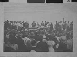
Photograph of patriotic celebrations probably in early Las Vegas, circa early 1900s
Date
1900 to 1939
Archival Collection
Description
The view of a patriotic celebration that included Harley Harmon (on left of speaker), probably located in early Las Vegas, Nevada.
Image
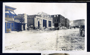
Photograph of a construction of Goldfield News building and Goldfield Hotel, Goldfield (Nev.), 1900-1920
Date
1900 to 1920
Archival Collection
Description
Site Name: Goldfield Hotel (Goldfield, Nev.)
The News Building (Goldfield, Nev.)
The News Building (Goldfield, Nev.)
Image
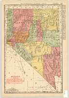
Map showing railroads in Nevada, 1904
Date
1904
Description
Relief shown by hachures. Added title: Rand McNally's new business map of Nevada. Shows range and township grid. Shows railroads. Color used to show boundaries of counties. Includes index to cities. On verso: Indexes to counties, lakes, mountains, rivers, towns, etc. Published by Rand McNally & Co. Scale [ca. 1:1,710,720]. 1 in. equals 27 miles (W 120°--W 114°/N 42°--N 35°). Originally published as pages 263 and 264 of Rand-McNally indexed atlas.
Text
Pagination
Refine my results
Content Type
Creator or Contributor
Subject
Archival Collection
Digital Project
Resource Type
Year
Material Type
Place
Language
Records Classification
