Search Results
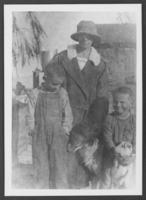
Photograph of Elda Gilcrease and sons, Las Vegas, Nevada, circa 1925
Date
1925
Archival Collection
Description
Elda Gilcrease with her sons, Ted and Bill, and their collie dog, "E-Z" at the Gilcrease Ranch. The family is from Reno, Nevada.
Image
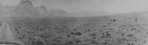
Photograph of the Old Spanish Trail, Southern Nevada, early 1900s
Date
1900 to 1930
Archival Collection
Description
Black and white view of the Old Spanish Trail in the early 1900s.
Image
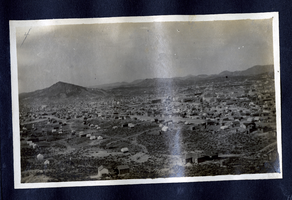
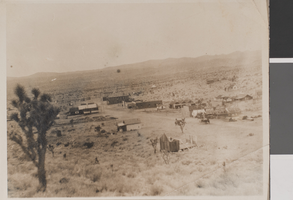
Photograph of Goldfield (Nev.), early 1900s
Date
1900 to 1925
Archival Collection
Description
Photograph of Goldfield (Nev.), early 1900s
Image
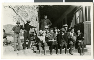
Photograph of Doris Hancock with teachers and students, Beatty, Nevada, circa 1925
Date
1925
Archival Collection
Description
Doris Hancock with Luella Nixon, Mary West Ronnow, Helen Buie, two boys with Whiteneck, and five unidentified teachers at Beatty, Nevada.
Image
Smoky Valley, Nevada and Round Mountain, Nevada, 1900-1988
Level of Description
Series
Scope and Contents
Materials contain photographs of the Smoky Valley and Round Mountain area from 1905 to 1980, and document the activities of the Carver, Carver-Duhme, Carver-Book, Rogers, Lofthouse-Berg, and Zaval families. Materials include photographs of Carver's Station, ranching, community events, animals, placer mining, Round Mountain Hotel, Round Mountain High School, mills, Main Street in Tonopah, and the Belmont Mine.
Archival Collection
Nye County, Nevada Photograph Collection
To request this item in person:
Collection Number: PH-00221
Collection Name: Nye County, Nevada Photograph Collection
Box/Folder: N/A
Collection Name: Nye County, Nevada Photograph Collection
Box/Folder: N/A
Archival Component
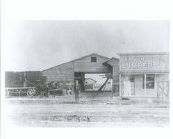
Photograph of Jake Beckley and Ed Von Tobel, Sr. in front of the Ed. Von Tobel Lumber Company, Las Vegas (Nev.), 1900-1925
Date
1905 to 1976
Archival Collection
Description
Ed Von Tobel, Sr. and Jake Beckley stand in front of the Von Tobel Lumber Company on South First Street in Las Vegas. Pictured are the office, lumber storage, shed and sales room. Beckley, Ed. Von Tobel Sr.'s business partner is seen standing on a horse-drawn wagon on the left. Behind the wagon are stacked shingles. The lumber company was founded in 1905, shortly after the Las Vegas townsite lot auction, but moved from its original location on South Main Street when that proved to be "too far out of town" for business. The South First Street building was destroyed by fire in 1914. Photograph taken 1905?-1906?
Image
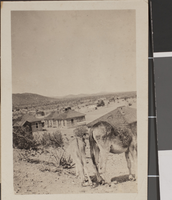
Photograph of Searchlight, Nevada, circa early 1900s
Date
1900 to 1930
Archival Collection
Description
A distant view of tents and cabins in Searchlight.
Image
Photograph of Searchlight, Nevada, circa early 1900s
Date
1900 to 1930
Archival Collection
Description
Houses in Searchlight. In the foreground of the image are the backsides of two donkeys.
Image
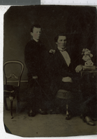
Tintype of unidentified men, Nevada, 1900-1910
Date
1900 to 1910
Archival Collection
Description
A photograph of two unidentified young gentlemen posing.
Image
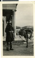
Photograph of a prospector, Reno, Nevada, 1900-1930
Date
1900 to 1930
Archival Collection
Description
A picture of a prospector and his burro in front of the First State Bank.
Image