Search Results
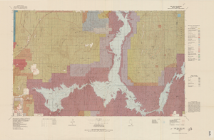
Topographic map of Lake Mead quadrangle, Nevada and Arizona, 1979
Date
Description
universal transverse Mercator proj. (W 115°00'--W 114°00'/N 36°30'--N 36°00'). Series: Surface-minerals management status. United States. Bureau of Land Management. Surface-minerals management status. Filing title: Lake Mead, Nev.--Ariz., 1979. Shows township and range lines. Published by United States, Dept. of the Interior, Bureau of Land Management
Denver, Colo. : For sale by U.S. Geological Survey,
Image
Nevada Women's History Project organizational records
Date
Archival Collection
Description
Folder from the Nevada Women's History Project Records (MS-00406).
Text
#68215: Landscape, Grounds & Arboretum facility supervisor Sandra Obenour-Dowd was named the Classified Staff Rookie of the Year on August 18, 2011, 2011 August 18
Level of Description
Archival Collection
Collection Name: University of Nevada, Las Vegas Creative Services Records (2010s)
Box/Folder: Digital File 00
Archival Component
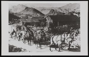
Stowell Whitney freighting out of Goodsprings, Nevada: photographic print
Date
Archival Collection
Description
Image
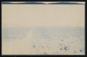
Road through the Nevada desert: postcard
Date
Archival Collection
Description
Image
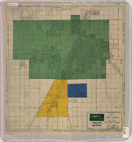
Map of Las Vegas and vicinity, Clark County, Nevada, April 15, 1951
Date
Description
Image

Aid for AIDS of Nevada fan
Date
Archival Collection
Description
Text
#70491: Joseph Morgan, College of Education Educational and Clinical Studies professor was named 2015 Alumi Faculty Member of the Year on September 23, 2015., 2015 September 23
Level of Description
Archival Collection
Collection Name: University of Nevada, Las Vegas Creative Services Records (2010s)
Box/Folder: Digital File 00
Archival Component
#70386: Margaret Covelli, chief nursing officer at Spring Valley Hospital and Medical Center is the School of Nursing Alumni of the Year. August 11, 2015., 2015 August 11
Level of Description
Archival Collection
Collection Name: University of Nevada, Las Vegas Creative Services Records (2010s)
Box/Folder: Digital File 00
Archival Component
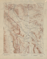
Topographic map of the Furnace Creek quadrangle, Nevada and California, 1947
Date
Description
'E.M. Douglas, geographer. R.H. Chapman, in charge of section. Topography by R.H. Chapman, B.D. Stewart, J.E. Blackburn and D.F.C. Moor. Traingulation by R.H. Chapman and D.F.C. Moor. Surveyed in1905-1906.' 'Edition of Apr. 1910, reprinted 1947.' Scale 1:250,000 ; polyconic proj. (W 117°00´--W 116°00´/N 37°00´--N 36°00´). Relief shown by contours and spot heights. 'North American datum.' 'Contour interval 100 feet.' 'Datum is mean sea level.' Text and illustrations from the Topographic maps of the United States series on verso. Series: The topograhic maps of the United States. United States, Dept. of the Interior, Geological Survey
Text