Search Results
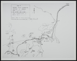
Map of Southen Nevada Geography: map
Date
Archival Collection
Description
Image
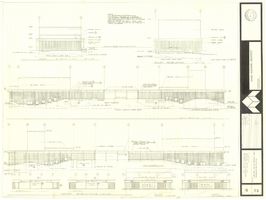
Architectural drawing of concert hall and drama theater, University of Nevada, Las Vegas, exterior elevations, November 5, 1969
Date
Archival Collection
Description
Exterior elevations for the concert hall and drama theater on the University of Nevada, Las Vegas campus, including a connecting courtyard. These buildings would become the Artemus W. Ham Concert Hall and the Judy Bayley Theatre. Sheet 6 of 35. "Drawn by G.T. Checked by K.D. Job number 6828. Scale 1/16" = 1'-0". Date Nov. 5, 1969"
Site Name: University of Nevada, Las Vegas
Address: 4505 S. Maryland Parkway
Image
Emma and William N. Schuyler (left) and Jack and Caroline Heaton in Denver, Colorado. Caroline is Emma’s sister (Caroline Schaefle) and was prominent in the Las Vegas real estate market in 1930s and 1940s: photographic print, approximately 1900
Level of Description
Archival Collection
Collection Name: Schuyler Family Photograph Collection
Box/Folder: Digital File 00
Archival Component
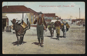
"A typical prospector's outfit, Tonopah, Nevada": postcard
Date
Archival Collection
Description
Image

Hydrogeologic map of Nevada Test Site and vicinity, southern Nevada, 1965
Date
Description
Image
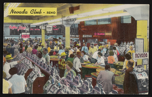
The Nevada Club in Reno, Nevada: postcard, image 001
Description
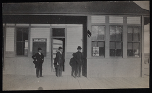
Railroad station, Goldfield, Nevada: photographic print
Date
Archival Collection
Description
Image
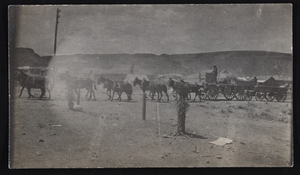
Ore team, Goldfield, Nevada: photographic print
Date
Archival Collection
Description
Image

Blueprint map showing proposed changes to water system, Las Vegas Land & Water Co., Las Vegas, Nevada, circa 1936
Date
Archival Collection
Description
Image

Report, Flood control and soil conservation in southern Nevada
Date
Archival Collection
Description
Brief history of flooding along the Virgin River and a list of work undertaken to prevent or diminish future flooding.
Text