Search Results
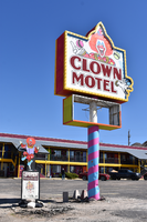
Clown Motel mounted sign, Tonopah, Nevada
Date
Archival Collection
Description
The mounted sign for the Clown Motel during the day with unlit neon.
521 N Main St, Tonopah, NV 89049
Clown Motel
Image
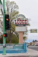
Fallon Lodge mounted sign, Fallon, Nevada
Date
Archival Collection
Description
The mounted sign for the Fallon Lodge during the day. The old neon reads "welcome" but lit neon installed in front reads "sorry."
25 North Taylor Street, 390 W Williams Ave, Fallon, NV
Fallon Lodge
Image
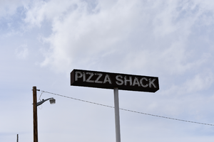
Pizza Shack mounted sign, Fernley, Nevada
Date
Archival Collection
Description
The mounted sign for the Pizza Shack during the day. The restaurant is permanently closed.
790 E Main St, Fernley, NV 89408
Pizza Shack
Image
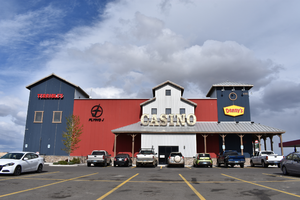
Terrible's wall mounted signs, Fernley, Nevada
Date
Archival Collection
Description
Wall mounted signs for Terrible's during the day, including signs for the Flying J and Denny's.
480 Truck Inn Way, Fernley, NV 89408
Terrible's Casino
Image
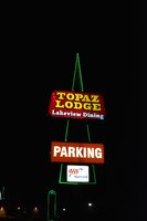
Topaz Lodge mounted sign, Gardnerville, Nevada
Date
Archival Collection
Description
The Topaz Lodge mounted sign with lit neon.
1979 US-395, Gardnerville, NV 89410
Topaz Lodge
Image
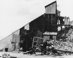
Panoramas: Goldfield and Tonopah, Nevada: photographic prints, image 006
Date
Description
Brian Jones Collection of Henderson, Nevada Aerial Photographs
Identifier
Abstract
The Brian Jones Collection of Henderson, Nevada Aerial Photographs contain 107 4"x6" photographic prints of Henderson, Nevada and the surrounding area from approximately 1997 to 2002 taken by longtime Las Vegas, Nevada photographer Brian Jones. Images depict the construction of residential areas, roads, and commercial buildings. Other images include the Green Valley community, Galleria at Sunset Mall, St. Rose Dominican Hospital, Titanium Metals Corporation (TIMET), and Henderson City Hall. Lastly, there are images of parking lots, industrial areas, and airport runways in Henderson and Las Vegas, Nevada.
Archival Collection

Digital image of Nevada Test Site protestors, circa 1980-1999
Date
Archival Collection
Description
Image
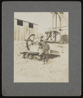
Front view of The Red Mill in Manhattan, Nevada: photographic print
Date
Archival Collection
Description
From the Nye County, Nevada Photograph Collection (PH-00221) -- Series VII. Other areas in Nye County -- Subseries VII.A. Boni Family (Manhattan, Nevada). Other mills in Manhattan included the Consolidated Mill and the White Cap Mill.
Image
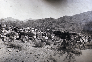
Slide of the Callville ruins, Callville, Nevada, circa 1930s
Date
Archival Collection
Description
Image