Search Results
Meeting minutes for Consolidated Student Senate, University of Nevada, Las Vegas, June 26, 1973
Date
Archival Collection
Description
Text

Plan of proposed new well pipe and fittings for Las Vegas, Nevada, 1936
Date
Archival Collection
Description
Image
Sister Rosemary Lynch in front of the Nevada Test Site entrance at Mercury, Nevada: digital photograph, 1987 July 07
Level of Description
Archival Collection
Collection Name: Sister Rosemary Lynch Photograph Collection
Box/Folder: Digital File 00
Archival Component
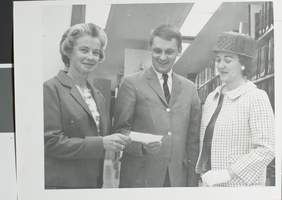
Photograph of individuals at University of Nevada, Las Vegas, circa 1970s
Date
Archival Collection
Description
Pictured from left to right: Mrs. Faunce, Hal Erickson, and Mrs. Newmann making a donation to the library at the University of Nevada, Las Vegas (UNLV).
Image
Clark County, Nevada United States Bicentennial Collection
Identifier
Abstract
The Clark County, Nevada United States Bicentennial collection dates from approximately 1970 to 1976. The collection documents Nevada's participation in the 1976 Bicentennial celebration of the American Revolution, as well as celebrations from other states and countries in Europe. The collection is comprised of official reports from the U.S. Bicentennial committee, scrapbooks from the Clark County bicentennial committee, newspapers, and event programs from bicentennial celebrations around the country. The collection also contains a film of various American states' bicentennial celebrations.
Archival Collection
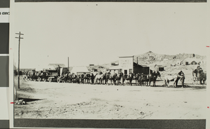
Photograph of Columbia townsite, Goldfield, Nevada, circa 1905-1907
Date
Archival Collection
Description
The boom days in the Columbia townsite at Goldfield, Nevada. Typed description provided on back of image: "Author/lecturer Stanley Paher recounts the Goldfield, Nevada boom days during a slide persentation at 7 p.m. Monday, October 31 at the new Las Vegas Library, 1726 E. Charleston, inside the Charleston Plaza Mall." Street Address: 1726 East Charleston Boulevard
Image

Events held in Tonopah, Nevada: photographic prints, image 001
Description
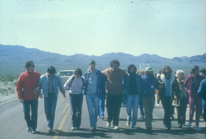
Slide of protesters linking arms and blocking the highway leading to the Nevada Test Site, 1983
Date
Archival Collection
Description
Image
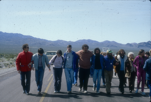
Slide of protesters linking arms and blocking the highway leading to the Nevada Test Site, 1983
Date
Archival Collection
Description
Image
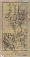
Map of a part of southern Nevada showing ground-water conditions, 1914
Date
Description
Image