Search Results
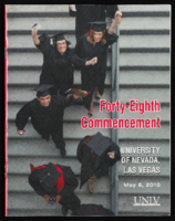
University of Nevada, Las Vegas (UNLV) 48th commencement program
Date
Archival Collection
Description
Commencement program from University of Nevada, Las Vegas Commencement Programs and Graduation Lists (UA-00115).
Text

University of Nevada, Las Vegas (UNLV) 44th commencement program
Date
Archival Collection
Description
Commencement program from University of Nevada, Las Vegas Commencement Programs and Graduation Lists (UA-00115).
Text
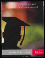
University of Nevada, Las Vegas (UNLV) 47th commencement program
Date
Archival Collection
Description
Commencement program from University of Nevada, Las Vegas Commencement Programs and Graduation Lists (UA-00115).
Text
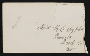
Letter and envelope from John. M. Bunker Eldorado Canyon, Nevada to Mary Etta Syphus, Panaca, Nevada
Date
Archival Collection
Description
From the Syphus-Bunker Papers (MS-00169). The folder contains an original handwritten letter, a typed transcription of the same letter, and the original envelope with the stamp removed, and a copy of the original letter
Text

Letter and envelope from Mary Etta Syphus, Panaca, Nevada to John M. Bunker, Eldorado Canyon, Nevada
Date
Archival Collection
Description
From the Syphus-Bunker Papers (MS-00169). The folder contains an original handwritten letter, a typed transcription of the same letter, the original envelope with the stamp removed, and a copy of the original letter.
Text
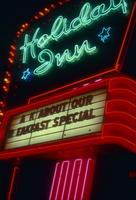
Slide of the Holiday Inn, Elko, Nevada, 1986
Date
Archival Collection
Description
Image
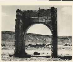
Photograph of ruins at Goldfield, Nevada, 1973
Date
Archival Collection
Description
Image

Film transparency of a view of Government Park and the Nevada Highway, Boulder City, Nevada, circa 1932-1940
Date
Archival Collection
Description
Image
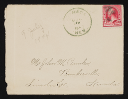
Letter and envelope from Mary Etta Syphus, Panaca, Nevada to John M. Bunker, Bunkerville, Nevada
Date
Archival Collection
Description
From the Syphus-Bunker Papers (MS-00169). The folder contains an original handwritten letter, an envelope, a typed transcription of the same letter, and a copy of original letter attached.
Text
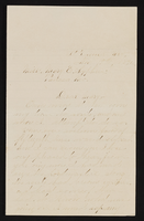
Letter from John M. Bunker, St. Thomas, Nevada to Mary Etta Syphus, Panaca, Nevada
Date
Archival Collection
Description
From the Syphus-Bunker Papers (MS-00169). The folder contains an original handwritten letter, a typed transcription of the same letter, and a copy of original letter attached.
Text