Search the Special Collections and Archives Portal
Search Results
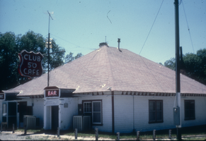
Slide of the Club 50 Cafe, McGill, Nevada, 1986
Date
1986
Archival Collection
Description
An image of the exterior of Club 50 Cafe, located on Highway 93 outside of Ely in McGill, Nevada. The red neon signs hanging off of the building read: "Club 50 Cafe; Bar."
Image
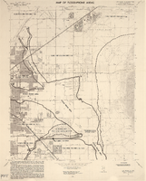
Maps of flood-prone areas in Las Vegas, Nevada, 1973
Date
1973
Description
'Prepared by the U.S. Department of the Interior, Geological Survey, in cooperation with the U.S. Department of Housing and Urban Development, Federal Insurance Administration. 1973.' Sheet 1: Las Vegas NE, Nev.; Sheet 2: Las Vegas SE, Nev.; Sheet 3:Las Vegas SW, Nev.; Sheet 4: Las Vegas NW, Nev. Published by Geological Survey (U.S.). Scale 1:24,000. [1 in. to approx. 2,000 ft.]. Relief shown by contours. Flood information overprinted on U.S. Geological Survey 7.5 minute topographic quadrangles: [sheet 1] Las Vegas NE quadrangle, [sheet 2] Las Vegas SE quadrangle, [sheet 3] Las Vegas SW quadrangle, [sheet 4] Las Vegas NW quadrangle, 1967. Shows areas subject to flooding by a flood that has 1 in 100 chance on the average of occurring in any one year. "Flood boundaries were estimated from: regional stage-frequency relations." Includes notes.
Image
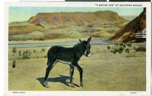
Postcard of a wild burro, Nevada, circa 1930s
Date
1930 to 1939
Archival Collection
Description
An artist's color rendering of a wild burro looking out to the Nevada desert. Written on back of postcard: "The burro is one of the pioneer characters of the old West. Though burro pack outfits are still to be seen on the desert, the day of the burro is passing, along with the gunman, the cowboy and Indian, and other historic features of by-gone days. Like the Indians, he may still be seen, a figure from the romantic past. With his echoing bray, his hardihood, his sleepy good nature and homely appearance, he is an extremely interesting local character." Postcard is titled "'A Native Son of Southern Nevada,"
Image
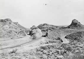
Photograph of a highway near Boulder City, Nevada, 1931
Date
1931
Archival Collection
Description
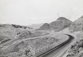
Highway near Boulder City, Nevada, 1931.
Image
Photograph of a highway near Boulder City, Nevada, 1931
Date
1931
Archival Collection
Description
Highway near Boulder City, Nevada, 1931.
Image
Photograph of towns, Nevada, circa early to mid 1900s
Date
1900 to 1969
Archival Collection
Description
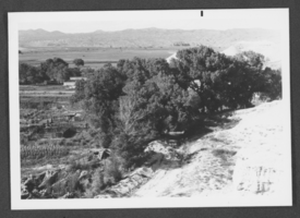
Shrubs and fencing in a town that is probably Panaca, Nevada.
Image
Photograph of Main Street, Manhattan, Nevada, February 3, 1907
Date
1907-02-03
Archival Collection
Description
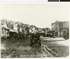
Men in an automobile on Main Street in Manhattan, Nevada.
Image
Photograph of steam tractor, Searchlight, Nevada, circa 1880s
Date
1880 to 1889
Archival Collection
Description
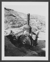
Old steam tractor in Eldorado Canyon, Nevada.
Image
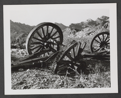
Photograph of ruined wagon, Searchlight, Nevada, circa 1880s
Date
1880 to 1889
Archival Collection
Description
Ruins of an old wagon in Eldorado Canyon, Nevada.
Image
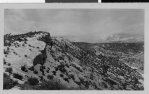
Photograph of the road to Mt. Charleston, Nevada, circa 1925
Date
1925
Archival Collection
Description
The road to Mt. Charleston through the Nevada desert.
Image
Pagination
Refine my results
Content Type
Creator or Contributor
Subject
Archival Collection
Digital Project
Resource Type
Year
Material Type
Place
Language
Records Classification
