Search Results
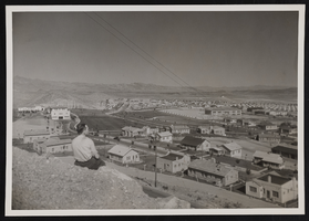
View of Boulder City: photographic print
Date
1930 (year uncertain) to 1933 (year uncertain)
Archival Collection
Description
An unidentified individual looks out towards Boulder City in the early 1930s.
Image
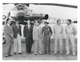
Photograph of Howard Hughes with XH-17 helicopter, Culver City, California, October 23, 1952
Date
1952-10-23
Archival Collection
Description
L-R: Rea Hopper, Director of the Aeronautical Division, Hughes Aircraft Company; Howard Hughes; Clyde Jones, Director of Engineering, Hughes Tool Company Aeronautical Division; Warren Reed, Assistant; Col. Carl E. Jackson, Air Research and Development Headquarters, Baltimore; Gale J. Moore, pilot; and unidentified pilot in front of the experimental helicopter XH-17 Flying Crane on October 23, 1952. This was one of Hughes' last public appearances.
Image
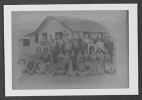
Photograph of people in front of Boulder City school, Boulder City, Nevada, 1932
Date
1932
Archival Collection
Description
An unidentified group of people in front of a Boulder City school in Boulder City, Nevada.
Image
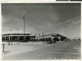
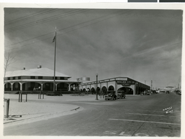
Photograph of Boulder City Co Stores, Boulder City, Nevada, circa 1930s
Date
1930 to 1939
Archival Collection
Description
Image of store fronts in Boulder City, inclduing Boulder City Co Stores
Image
Photograph of the Boulder City Co. Stores, Boulder City, Nevada, circa 1930s
Date
1930 to 1939
Archival Collection
Description
Shop fronts in Boulder City, with the Boulder City Co. Stores building in the middle.
Image
Mayor Fiorello La Guardia on the steps of City Hall receiving Howard Hughes and his crew: Ed Lund, Richard Stoddart, Thomas Thurlow, and Harry Connor, 1938 July 15
Level of Description
File
Archival Collection
Howard Hughes Public Relations Photograph Collection
To request this item in person:
Collection Number: PH-00373
Collection Name: Howard Hughes Public Relations Photograph Collection
Box/Folder: Folder 12
Collection Name: Howard Hughes Public Relations Photograph Collection
Box/Folder: Folder 12
Archival Component