
Search the Special Collections and Archives Portal

Search Results

Display    Results Per Page
Displaying results 1871 - 1880 of 143732

Photograph of Howard Hughes, circa late 1930s

Date

1935 to 1939

Description

The black and white view of Howard Hughes being photographed in the passenger seat of a car.

Image

Ball, Howard. Justice Downwind: America's Atomic Testing Program in the 1950's. New York: Oxford University Press, 1986

Level of Description

Item

Archival Collection

Alice P. Broudy Papers on Broudy v. United States
To request this item in person:
Collection Number: MS-00097
Collection Name: Alice P. Broudy Papers on Broudy v. United States
Box/Folder: Box 1

Archival Component

Map showing U.S. Bureau of Reclamation Region 3 projects in Arizona, California, Nevada, New Mexico and Utah, September 1967

Date

1967-09

Description

'United States, Department of the Interior, Stewart L. Udall, Secretary. Bureau of Reclamation, Floyd E. Dominy, Commissioner.' 'Map. No. X-300-738. September 1967.' Scale [ca. 1:1,774,080] (W 119°--W 108°/N 39°--N 32°). Relief shown pictorially. Shows completed, under construction and proposed dams and reservoirs, canals, and aqueducts, power plants, pumping plants, substations, transmission lines, tunnels and siphons. Also shows non-Bureau of Reclamation dams, reservoirs, tunnels, pipelines and irrigated lands. Includes inset map of location of Region 3 and key map of drainage basins. Bureau of Reclamation, [Region 3?].

Image

Photograph of Richard Kirman, Nevada, circa 1935-1938

Date

1935 to 1938

Description

Nevada Governor Richard Kirman from 1935-1938.

Image

Photograph of Howard Hughes, 1937

Date

1937

Description

Howard Hughes alighting from a Stinson Reliant SR-9 aircraft.

Image

Landscaping in front of the former North Las Vegas City Hall building with new City Hall building in background in North Las Vegas, Nevada: digital photograph

Date

2019-02-06

Description

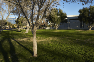
From the UNLV University Libraries Photographs of the Development of the Las Vegas Valley, Nevada (PH-00394). Part of the collection documents the entire 19 mile length of the north/south Eastern Avenue / Civic Center Drive alignment. This photograph was captured in the section of Civic Center Drive between Las Vegas Boulevard and Lake Mead Boulevard.

Image

Geologic map of the northeast quarter of the Bullfrog 15-minute quadrangle, Nye County, Nevada, 1990

Date

1990

Description

58 x 46 cm., on sheet 87 x 102 cm., folded in envelope 30 x 24 cm. Relief shown by contours and spot heights. "Contour interval 40 feet." "Base from U.S. Geological Survey 1:62,500. 1954." "Geology mapped in 1985 and 1988." Includes text, bibliography, 4 col. cross sections, and location and index maps. "Prepared in cooperation with the U. S. Atomic Commission." Original publisher: U. S. Geological Survey, Series: Miscellaneous investigations series, map I, Scale: 1:24 000.

Image

Las Vegas Age, Vol. 34, No. 43 (1938-10-28), page 15

File
Download 0537.jp2 (image/jp2; 4.49 MB)

Section

Section Two

Page

15

Digital ID

sn86076141_1938102801_015

Las Vegas Age, Vol. 34, No. 44 (1938-11-04), page 15

File
Download 0561.jp2 (image/jp2; 4.42 MB)

Page

15

Digital ID

sn86076141_1938110401_015

Las Vegas Age, Vol. 34, No. 28 (1938-07-15), page 10

File
Download 0328.jp2 (image/jp2; 4.71 MB)

Page

10

Digital ID

sn86076141_1938071501_010