Search Results
Howard Hughes's HK-1 Hercules traveling down a street in Culver City, California, 1946 June 16
Level of Description
Archival Collection
Collection Name: Howard Hughes Public Relations Photograph Collection
Box/Folder: Folder 21
Archival Component
Howard Hughes's HK-1 Hercules traveling down a street in Culver City, California, 1946 June 16
Level of Description
Archival Collection
Collection Name: Howard Hughes Public Relations Photograph Collection
Box/Folder: Folder 21
Archival Component
Howard Hughes's HK-1 Hercules traveling down a street in Culver City, California, 1946 June 16
Level of Description
Archival Collection
Collection Name: Howard Hughes Public Relations Photograph Collection
Box/Folder: Folder 21
Archival Component
Howard Hughes and Clifford Adams at microphone of Station WINS in New York City, 1936 January 16
Level of Description
Archival Collection
Collection Name: Howard Hughes Public Relations Photograph Collection
Box/Folder: Folder 01
Archival Component
Minutes of meeting at City Hall council chambers regarding the best ways to control flooding in Southern Nevada, March 7, 1950
Date
Archival Collection
Description
Meeting called to discuss the best ways to control flooding in Southern Nevada.
Text
Harry Hall oral history interview
Identifier
Abstract
Oral history interview with Harry Hall conducted by Dennis McBride on June 20, 1986 for the Boulder City Library Oral History Project. Hall discusses how the hope of work on the dam encouraged his move to Nevada with his mother and stepfather. He then talks at some length about living in a tent in Ragtown, the various illegal bootlegging establishments along the dirt road running between Las Vegas and Boulder City, Nevada, and working on the dam. He continues talking about working conditions, the heat, and the labor strike at the dam in August, 1931.
Archival Collection
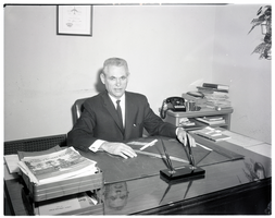
Film negative of Mayor Oran K. Gragson seated at his desk in City Hall, Las Vegas, Nevada, December 21, 1961
Date
Archival Collection
Description
Image
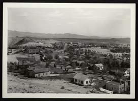
Panoramic photograph of Boulder City, Nevada, circa 1932-late 1930s
Date
Archival Collection
Description
Image
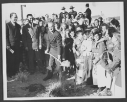
Photograph of Boulder City High School groundbreaking ceremony, Boulder City, March 04, 1949
Date
Archival Collection
Description
Image
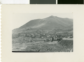
Photograph of Virginia City, Nevada, circa early 1900s
Date
Archival Collection
Description
Image