Search Results
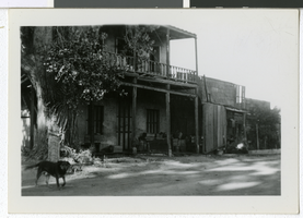
Photograph of a house, Carson City, Nevada, circa 1920s
Date
Archival Collection
Description
Image
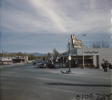
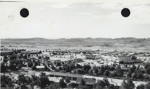
Film transparency of Boulder City, Nevada, circa 1931-1936
Date
Archival Collection
Description
Image
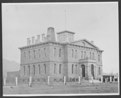
Photograph of Carson City Mint, Nevada, circa 1866
Date
Archival Collection
Description
Image
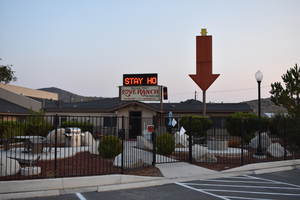
Love Ranch mounted sign, Carson City, Nevada
Date
Archival Collection
Description
View of the mounted arrow sign for the Love Ranch in Carson city in the evening with unlit neon. A detail shot of a star sign is shown.
95 Kit Kat Dr, Carson City, NV 89706
Love Ranch
Image
Bureau of Reclamation Photographs of the Hoover Dam and Boulder City, Nevada
Identifier
Abstract
The Bureau of Reclamation Photographs of the Hoover Dam and Boulder City, Nevada depict the construction of the Hoover (Boulder) Dam and the development of Boulder City, Nevada from 1869 to 1974, with a bulk of the materials dating from 1929 to 1940. The photographs primarily depict the construction operations in Black Canyon, including digging tunnels, pouring concrete, building the power plant, and inspections by Bureau of Reclamation engineers. The photographs also depict Boulder City, including schools, workers, and dormitories. The collection also includes photographs of St. Thomas, Nevada, Lake Mead, Nelson’s Landing, Nevada, and an archaeological excavation near Lake Mohave, Nevada.
Archival Collection
Boulder City housing developments: photographic prints, image 001
Description
Kyle and Lee Canyons, Spring Mountain, Belknap Photographic Services, Boulder City, Nevada, 1952 July 15
Level of Description
Archival Collection
Collection Name: Chester R. Longwell Professional Papers
Box/Folder: Box 24
Archival Component
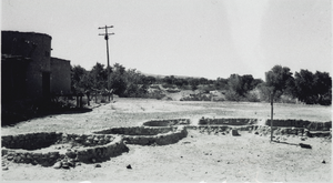
Photograph of the Lost City site, near Overton, Nevada, 1938-1939
Date
Archival Collection
Description
Image
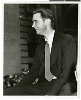
Photograph of a parade procession for Howard Hughes, New York, July 15, 1938
Date
Archival Collection
Description
Image
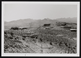
Photograph of Boulder City, Nevada, circa 1936-1937
Date
Archival Collection
Description
Image