Search Results
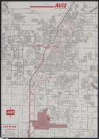
Map of metropolitan Las Vegas, Nevada, 1971
Date
Description
Text
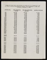

Las Vegas Westside: newspaper clippings, community programs, and correspondence
Date
Archival Collection
Description
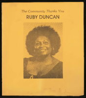
Folder of materials from the Mabel Hoggard Papers (MS-00565) -- Civic engagement file. Las Vegas Westside newspaper clippings, community programs, and correspondence. This folder includes a program for a tribute to Ruby Duncan; Operation Life Community Press newsletter, Year 1, Volume 4, March 1978; Westside Council summary; Westside Federal Credit Union Education Committee records; and Nevada Equal Rights Commission letters and amended statistical report, March 16, 1978.
Mixed Content
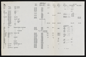
Articles of Incorporation for Las Vegas Pops Orchestra, July 28, 1977
Date
Archival Collection
Description
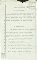
The articles of incorporation for the Las Vegas Pops Orchestra were filed with the State of Nevada in 1977, establishing the group as a non-profit entity with a board of trustees made up of Hyman Gold, Ruth Gold, Fred Franke, Roxy Gyeer and Thelma Dicerto.
Text
News clips showing the construction progress of the Stratosphere Tower: video
Date
Archival Collection
Description
A series of news clips showing the construction progress for the Stratosphere Tower; clips show multiple news presenters from various news stations including Steve Crupi from KTNV-TV Channel 13, Bianca Ferrare from KVBC Channel 3, and other presenters from KLAS-TV Channel 8; people interviewed in the clips include Donald Peterson from Vegas World; Dave Cruce, foreman; Ronald Willis, a Las Vegan; Raymond Lafaire, a tourist; Jerry Miller, crew worker; and other unidentified people and construction workers; a video montage of aerial views of construction is also shown; b-roll of press announcement, Stratosphere Tower drawings, ground breaking, construction, and Las Vegas. Original media VHS, color, aspect ratio 4 x 3, frame size 720 x 486. From the Bob Stupak Professional Papers (MS-01016) -- Professional papers -- Audiovisual material -- Digitized audiovisual clips file.
Moving Image
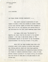
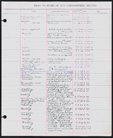
Report by the Freeman Company publicist regarding the Sands Hotel in Las Vegas, circa October 18, 1953- October 18, 1959
Date
Archival Collection
Description
Mixed Content