Search the Special Collections and Archives Portal
Search Results
Jean Ford Papers
Identifier
Abstract
The Jean Ford Papers (1958-1996) include political documents, campaign materials for Jean Ford's political campaigns, and materials pertaining to campaign issues such as health services, general improvement districts, and parks and recreation. There is extensive material on Red Rock National Conservation Area, Lake Mead National Recreation Area, and the National Issues Forum. Women's issues cover the years 1964-1981 and contain information relating to the League of Women Voters, Equal Rights Amendment (ERA), and International Women's Year (IWY), as well as Anti-ERA and Anti-IWY materials.
Archival Collection
Pittman Family Photographs
Identifier
Abstract
The Pittman Family Photographs depict members of the Pittman and Brewington families in Nevada from 1903 to 1989. The photographs primarily depict Nevada Governor Vail Pittman and his wife Ida Louise “Liz” Brewington Pittman at political campaign and fundraising events, including the Helldorado Parade in Las Vegas, Nevada and at the Governor’s Mansion in Carson City, Nevada. The photographs also depict Governor Pittman with President Harry S. Truman, Jim Cashman, and family members. The photographs also include a group photograph of U.S. Senator Key Pittman with business executives representing the Union Pacific Railroad and the San Pedro Railroad. The collection also contains family photographs of Ann Brewington, Ida Brewington Pittman's sister, as well as a letter sent to Vail Pittman in 1903.
Archival Collection
Helen J. Stewart Photographs
Identifier
Abstract
The Helen J. Stewart Photographs depict the Stewart Family from approximately 1860 to 1950. The photographs primarily depict Helen J. Stewart and her children as well as the Stewart Ranch (also know as the Las Vegas Ranch) in Southern Nevada. The photographs include the early Las Vegas, Nevada town site, landscapes of Southern Nevada and the American Southwest, mines and mining camps, railroads and railroad workers, the Las Vegas Fort (also known as the Old Mormon Fort), hotels and early businesses in Las Vegas, Native Americans and Native American artifacts, and postcards.
Archival Collection
Yucca Mountain Site Characterization Office Collection
Identifier
Abstract
The Yucca Mountain Site Characterization Office collection (1958-2001) was assembled through a joint effort between the Nuclear Regulatory Commission (NRC) and the James R. Dickinson Library, University of Nevada, Las Vegas (UNLV) to provide public access to documentation and correspondence about the proposed high-level radioactive waste geologic repository site near Yucca Mountain, Nevada. Materials include technical reports, contractor reports, public hearing transcripts, safety evaluation reports, environmental impact statements, emergency plans, inspection reports, licensee event reports, and general communications. The collection includes documents from several other government entities such as the Yucca Mountain Site Characterization Office, Department of Energy, Office of Civilian Radioactive Waste Management (OCRWM), Nevada Nuclear Waste Storage Investigations (NNWSI), United States Geological Survey (USGS), Sandia National Laboratories, Lawrence Livermore National Laboratory, and Los Alamos National Laboratory.
Archival Collection

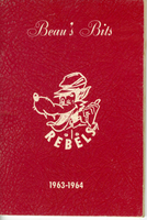
"Beau's Bits": Nevada Southern University Student Handbook
Date
Archival Collection
Mixed Content

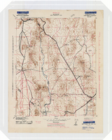
Topographic map of the Camp Mohave quadrangle in California, Nevada and Arizona, 1942
Date
Description
Image

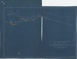
Blueprint map showing proposed new 12" well and pipe line changes at water springs, Las Vegas, Nevada, circa 1920
Date
Archival Collection
Description
Image

