Search Results
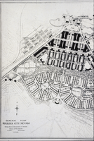
Slide of an architectural drawing of Boulder City, Nevada, March 5, 1931
Date
1931-03-05
Archival Collection
Description
A black and white image of architectural layout plans for Boulder City.
Image
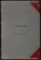
Las Vegas City Ordinances, March 31, 1933 to October 25, 1950
Date
1933-03-31 to 1950-10-25
Archival Collection
Description
Bound volume of Las Vegas City Ordinances, March 31, 1933 to October 25, 1950
Text
State of New Jersey Casino Control Commission, "Economic Impact Report, Atlantic City Gaming Industry", 2007
Level of Description
File
Archival Collection
Gary W. Royer Collection on Gaming
To request this item in person:
Collection Number: MS-00658
Collection Name: Gary W. Royer Collection on Gaming
Box/Folder: Box 138
Collection Name: Gary W. Royer Collection on Gaming
Box/Folder: Box 138
Archival Component
Slide images of Harrah's Reno, Harrah's Lake Tahoe, and Harrah's Marina in Atlantic City, New Jersey, undated
Level of Description
File
Archival Collection
Harrah’s Entertainment Corporate Archives
To request this item in person:
Collection Number: MS-00460
Collection Name: Harrah’s Entertainment Corporate Archives
Box/Folder: Box 046
Collection Name: Harrah’s Entertainment Corporate Archives
Box/Folder: Box 046
Archival Component
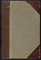
Las Vegas City Ordinances, July 18, 1911 to March 31, 1933
Date
1911-07-18 to 1933-03-31
Archival Collection
Description
Bound volume of Las Vegas City Ordinances, July 18, 1911 to March 31, 1933
Text
"Fink's NYRA Proposal as It Would Affect OTB" for the New York City Off-Track Betting Corporation, 1981
Level of Description
File
Archival Collection
Eugene Martin Christiansen Papers
To request this item in person:
Collection Number: MS-00561
Collection Name: Eugene Martin Christiansen Papers
Box/Folder: Box 045
Collection Name: Eugene Martin Christiansen Papers
Box/Folder: Box 045
Archival Component
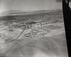
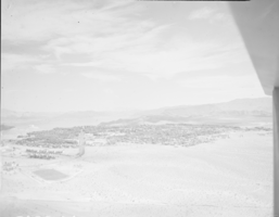
Photograph of Boulder City, Nevada, March 28, 1937
Date
1937-03-28
Archival Collection
Description
The grayscale, aerial view of Boulder City, Nevada. The prominent road of Nevada Way can be seen passing through the little town with the great reservoir of Lake Mead residing in the background. Bits of the actual plane from which the photo was taken can be seen alongside the right border of the image.
Image
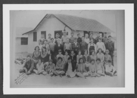
Photograph of students, Boulder City, Nevada, 1932
Date
1932
Archival Collection
Description
Boulder City students.
Image
Film transparency of Boulder City, Nevada, circa 1931-1936
Date
1931 to 1936
Archival Collection
Description
An image showing an aerial view of Boulder City. The outlines of the small city are distinctively marked by the stark contrast between the city's greenery and the surrounding desert. Bits of the airplane from which the image itself was taken can be seen in the upper right corner of the photograph.
Image
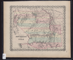
Map showing the territories of New Mexico and Utah, 1855
Date
1855
Description
'Entered according to Act of Congress in the year 1855 by J.H. Colton & Co. in the Clerk's Office of the Dist. Court of the U.S. for the South'n. Dist. of New York.' Scale [ca. 1:4,752,000. 1 in. to approx. 75 miles] (W 120°--W 102°/N 43°--N 32°). Shows natural features, and populated places, wagon route, proposed railroad routes and explorers' routes. Relief shown by hachures. Prime meridians: Greenwich and Washington.Hand colored. Atlas p. number in lower-right margin: 51. Decorative border. J.H. Colton & Co.
Image