Search Results
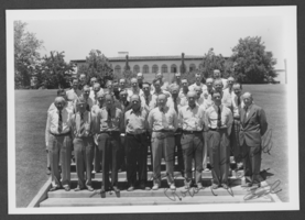
Photograph of Boulder City Rotary Club, circa 1907-1950s
Date
1907 to 1959
Archival Collection
Description
Unidentified members of the Boulder City Rotary Club posing in what is most likely Boulder City, Nevada. The front of the image is signed, "Best Wishes, Ed."
Image
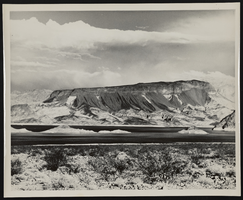
Photograph of Fortification Hill, Boulder City (Nev.), 1940s
Date
1940 to 1949
Archival Collection
Description
Fortification Hill. Clouds are in the sky above and Lake Mead's water can be seen below. Photograph by Bureau of Reclamation, Boulder City, Nevada.
Image

Photograph of the parking entrance at the Showboat Hotel and Casino (Atlantic City) 1987
Date
1987
Archival Collection
Description
Entrance to the parking garage at the Showboat Hotel and Casino in Atlantic City.
Site Name: Showboat Hotel and Casino (Atlantic City)
Address: 801 Boardwalk, Atlantic City, NJ
Image
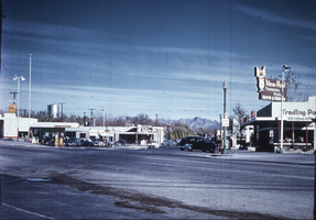
Slide of downtown Boulder City, Nevada, circa 1930s to 1940s
Date
1936 to 1949
Archival Collection
Description
A general view of Downtown Boulder City.
Image
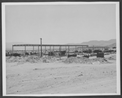
Photograph of high school construction, Boulder City, Nevada, 1949
Date
1949
Archival Collection
Description
Beginning of Boulder City High School.
Image
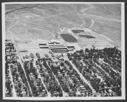
Photograph of high school, Boulder City, Nevada, circa 1952
Date
1952
Archival Collection
Description
Aerial of Boulder City High School.
Image
City of Las Vegas; General Plan - Summary Edition by Las Vegas City Council, approximately 1960 to 1980
Level of Description
File
Archival Collection
Clark County Planning Commission Research Library Collection
To request this item in person:
Collection Number: MS-01027
Collection Name: Clark County Planning Commission Research Library Collection
Box/Folder: Box 87
Collection Name: Clark County Planning Commission Research Library Collection
Box/Folder: Box 87
Archival Component

Map of California, Utah, Nevada, Colorado, New Mexico and Arizona, 1864
Date
1864
Description
'Johnson's California, with Utah, Nevada, Colorado, New Mexico, and Arizona, published by Johnson and Ward.' 'Entered according to Act of Congress in the Year 1864 by A.J. Johnson in the Clerks Office of the District Court of the United States for the southern district of New York.' Atlas page numbers in upper margin: 66-67. This is probably plate 67 from Johnson's New Illustrated Family Atlas, published in New York by Johnson & Ward in 1864. Shows natural features, locations of Indian tribes, proposed railroad routes, routes of explorers, trails, county boundaries and populated places ; "." ; Relief shown by hachures ; Prime meridians: Greenwich and Washington ; In top margin: 66-67 ; Hand colored ; On verso: Historical and statistical view of Mexico and central America (p. 79) and Historical and statistical view of the United States, 1860 (p. 78) Scale [ca. 1:3,484,800]. 1 in. to ca. 55 miles (W 124°--W 102°/N 42°--N 32°)
Text
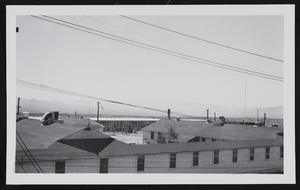
Photograph of buildings at Camp Williston, Boulder City (Nev.), 1940s
Date
1940 to 1949
Archival Collection
Description
Buildings at Camp Williston in Boulder City, Nevada.
Image
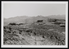
Boulder City housing developments: photographic prints, image 001
Description
Hoover Dam and U.S. Bureau of Reclamation. Boulder City housing developments, 1978.